Addressing Earthquake Hazards with LiDAR, GPS, and InSAR in Upper-level Undergraduate Courses
Thursday, April 13th
10:00 am PT | 11:00 am MT | 12:00 pm CT | 1:00 pm ET
Presenters: Beth Pratt-Sitaula (UNAVCO), Gareth Funning (University of California-Riverside), and Phil Resor (Wesleyan University)
This webinar is part of a series supporting teaching with InTeGrate principles, using InTeGrate-developed and curated materials as tools. The modules in this webinar are from an InTeGrate sister-project called "GEodesy Tools for Societal Issues" GETSI.
Resources, including presentation slides and the Screencast recording after the webinar
Summary
Goals
At the end of this webinar, participants will have:
- better awareness of ways to integrate GPS, LiDAR, and InSAR data and quantitative skills into undergraduate majors-level courses
- strategies to engage students in geoscience learning through community-level earthquake preparedness planning
- greater familiarity with GETSI (GEodesy Tools for Societal Issues) teaching resources and principles
- connections to new colleagues engaged in this work
Logistics
Time - 10:00 am PT | 11:00 am MT | 12:00 pm CT | 1:00 pm ET
Duration - 1 hour
Format - Online web presentation via Adobe Connect web conference software with questions and discussion.
Go to the webinar technology page for information on using Adobe Connect.
Detailed instructions for joining the webinar will be emailed to registered participants one day prior to the webinar.

Registration is now closed.
Preparation - There is no advance preparation required for this webinar.
Please email Rory McFadden (rmcfadden@carleton.edu) if you have any questions about this event.
Presenters
Beth Pratt-Sitaula, Education and Community Engagement, UNAVCO
Phil Resor, Earth and Environmental Sciences, Wesleyan University
Gareth Funning, Earth Sciences, University of California-Riverside
Program
ITG GETS webinar Earthquakes 4_13_17 (PowerPoint 2007 (.pptx) 36.2MB Apr13 17)
1) Welcome and introductory remarks - Rory McFadden, SERC staff
2) Overview of InTeGrate and GETSI Guiding Principles and development process – Beth Pratt-Sitaula
3) GPS, Strain, and Earthquakes module – Phil Resor
- Using GPS measurements of ongoing deformation to study crustal strain and earthquake hazards and risks
- Overview of module and examples of activities and student work
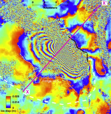
4) Imaging Active Tectonics with LiDAR and InSAR module – Gareth Funning
- Using LiDAR and InSAR to better identify active landforms and characterize recent earthquakes to assess earthquake risk
- Overview of module and walk-through of InSAR exercise
5) Reflections by participants
- Prompt: How do you incorporate (or plan to incorporate) cutting-edge tools to strengthen your course that addresses earthquake hazards or crustal strain? What are some challenges to using these tools in your courses?
The convener will reflect on the chat provide a synthetic remark. The chat and final remarks will be discussed further in the InTeGrate discussion thread. This online interest group is aimed at providing you with a platform for continuing discussion and exchanging ideas with your new colleagues about addressing earthquake hazards with cutting-edge tools, as well as broader InTeGrate and GETSI principles.
7) Opportunities for further interaction – Rory McFadden
8) Webinar Evaluation
Resources
- Teaching for a Sustainable Future
- GETSI modules
- GPS, Strain, and Earthquakes module
- Imaging Active Tectonics with LiDAR and InSAR module


