
Spatial Thinking Journal Club Findings
This summary was compiled by Carol Ormand, Science Education Resource Center.
From January to May, 2012, the Spatial Thinking Journal Club met once a month to explore the cognitive aspects of spatial thinking and the implications for geoscience education and research. Key findings from our discussions are summarized below.
 Geology students making observations on a field trip. Deciphering how these dipping strata fit into the regional geology requires spatial visualization skills. Photo courtesy of Kaatje Kraft.
![[creative commons]](/images/creativecommons_16.png)
Read about
- Teaching and learning spatial skills
- Variability in students' skills
- Spatial skills in STEM
- Problem-solving strategy choices and the expert-novice continuum
- Recommendations for designing instructional materials
- References
Teaching and learning spatial skills
- Spatial skills can be learned (e.g. Titus and Horsman, 2009; Uttal and Cohen, 2011). So far, the best-known method for boosting spatial skills is to give people ample opportunities to practice the specific skills that are needed. Sarah Titus and Eric Horsman have had some success in training geology students in spatial thinking tasks relevant for structural geology. Bob Krantz reports success as well in his 3D interpretation training program for new hires at ConocoPhillips.
- Timely feedback is essential to learning, and no less so to learning spatial skills.
- Spatial skills appear to be more important for early learning within a spatially-intensive discipline. That is, weak spatial skills present a barrier to learning for novices, but less of a barrier to learning for experts (Uttal and Cohen, 2011). Consequently, students' skills need to be trained up to a threshold level to avoid having low-spatial skill individuals drop out of the discipline.

Architectural drawings, various views of a cabin, including a cross-section through a staircase.
- There is some question of how transferable spatial skills are. That is, when people practice a general skill (cross-sectioning, for example), how well can they apply it in a new situation? This question has profound implications for STEM education. Are students more effectively provided with spatial skills by being given decontexualized training or training that employs disciplinary content? It is not clear which method will best result in effective employment of spatial reasoning, and generalization of skills to new problems.
- In addition to abstract spatial skills and spatial skills in the discipline, we need to think of a third category, not geologic or abstract but skills related to some other familiar context. For example, cross sections of the human body as opposed to cross sections of abstract objects or geologic structures. Getting students to think of cross sections of a familiar object may be particularly motivating to students and give them a sense of competence. It may also help them to realize that cross-sectioning is a generalizable, transferable skill.
- It is important to realize how hard it is to learn the spatial skills experts rely on to solve geologic problems. We are asking people to imagine things that they have never seen; in some cases, we ask them to visualize things that cannot be seen. Some students may give up trying if we don't acknowledge the inherent challenge of the tasks we set before them.
Variability in students' skills
- There is considerable variation in students' spatial thinking skills.
- Individual differences are always vastly larger than differences between groups. For example, individual variation completely outweighs gender differences.
- Gender differences go away when the tasks become really challenging -- when you really have to stop and think it through. Motivation is certainly a factor.

Discussion in the field
- The level of individual variation in spatial thinking skills provides a framework for contextualizing students' performance in different settings. For example, some geology students excel in the classroom but not in the field; others excel in the field but not in the classroom (at least prior to relevant field experience). Some of these differences are likely due to variations in spatial thinking skills.
- Other factors may compensate for weak spatial skills in determining academic success. Motivation and effort may make up for lack of spatial visualization. In a study of microscopy skills in a biology class, students' spatial skills did not correlate with course success, despite the instructor's certainty that spatial skills are essential to understanding what one sees through the microscope. (John Pani, personal communication.)
Spatial skills in STEM
- Different STEM disciplines require different combinations of spatial skills, according to self-report by experts. Understanding which spatial skills are important in any area of science is important for guiding curriculum development.
- In geology, we think that both spatial visualization and object visualization (Kozhevnikov et al., 2005) are important. For example, detecting geo-significant patterns in a seismic reflection profile depends on object visualization, while interpreting those patterns (imagining the subsurface structures) requires spatial visualization.
- In geology, it's important to be able to see a trend in noisy data, but also to be able to see the noise. Many of our students appear to be good at one or the other of these kinds of skills.
Problem-solving strategy choices and the expert-novice continuum
- Spatial skills may be more important early in the process of learning to be a scientist, engineer, or mathematician. Experts appear to rely on domain knowledge, and sometimes on analytical methods, to solve problems. However, experts are likely to continue to need spatial skills in solving new types of problems. We speculate that this is also true of novices, but they have a much smaller mental library of problems they have already solved, and thus must rely on spatial reasoning more often.
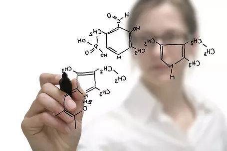
Chemical compound being drawn by female chemist. Image courtesy of the United States Department of Defense.![[reuse info]](/images/information_16.png)
- We can scaffold students' abilities to choose appropriate strategies. A chemistry professor taught three sections of his class in three different ways: modeling visual problem-solving methods, modeling analytical problem-solving methods, and modeling both visual and analytical problem-solving methods. Controlling for all other variable, students in the third section were best equipped to solve chemistry problems at the end of the term.
- How can we best help students to choose the best strategy? Should we be telling them what choices to use when, guiding their choices, modeling the process of choosing a strategy, or simply letting them muddle through? Having them muddle through is probably not much better than what we are doing now, and is likely to result in those who don't hit on the best strategies dropping out of our programs.
Recommendations for designing interventions (instructional materials or methods) to enhance spatial skills
- Context provides motivation. Give students examples of how spatial skills can be used to solve real-world problems.
- In museum exhibits, moving parts and cut-aways draw people's attention. Give students objects (models) to hold and manipulate. To the extent that it is possible, put each student in control of his or her learning environment (rather than having them observe an instructor or classmate manipulate objects, models, or visualizations).
- Pay attention to what has worked in training spatial skills in other domains. For example, computer simulations have been used effectively in training surgeons to perform spatially challenging tasks (Keehner et al., 2006). Similarly, computer graphics can show us the inside of structures that we cannot see in real life; seeing a computer visualization of the human skull can be more informative than seeing an actual skull.
- However, static computer graphics may be of limited utility for some low-spatial learners. For these individuals, the ability to rotate a scene around the vertical may be necessary to get a sense of the three-dimensionality of an object. (This is called the kinetic depth effect, or structure from motion.) See, for example, this 2D photo and an animated version created by "wiggling" it (scroll down for the animation).
- Current 3D graphics visualizations being used in industry exploit depth cues such as rotations and light sources, and are also moving away from 3D glasses. Free or low-cost software is available to academics so that they can adapt this. 3D rendering devices also allow us to produce physical objects that people can explore.
Read our recommendations for research related to spatial thinking in STEM.
References
- Hegarty, 2010, Components of Spatial Intelligence. In B. H. Ross (Ed.), The Psychology of Learning and Motivation, v. 52, pp. 265-297. San Diego: Academic Press.
- Ishikawa and Montello, 2006, Spatial knowledge acquisition from direct experience in the environment: Individual differences in the development of metric knowledge and the integration of separately learned places. Cognitive Psychology, v. 52, pp. 93-129.
- Keehner et al., 2006, Learning a Spatial Skill for Surgery: How the Contributions of Abilities Change with Practice. Applied Cognitive Psychology, v. 20, pp. 487-503.
- Kozhevnikov et al., 2005, Spatial Versus Object Visualizers: A New Characterization of Visual Cognitive Style. Memory and Cognition, v. 33, n. 4, pp. 710-726.
- Liu, Levy, Barton and Iaria, 2011, Age and gender differences in various topographical orientation strategies. Brain Research, v. 1410, pp. 112-119.
- Piburn et al., 2005, The Role of Visualization in Learning From Computer-Based Images. International Journal of Science Education, v. 27, n. 5, pp. 513-527. (Supplementary reading: The online tutorials developed by Steve Reynolds et al., described in this article: Visualizing Topography (more info) and GeoBlocks 3D (more info) .)
- Piburn, Kraft, and Pacheco, 2011, A New Century for Geoscience Education Research. Prepared for the National Academies Board on Science Education Committee on the Status, Contributions, and Future Directions of Discipline-Based Education Research.
- Titus and Horsman, 2009, Characterizing and Improving Spatial Visualization Skills. Journal of Geoscience Education, v. 57, n. 4, pp. 242-254.
- Uttal and Cohen, in press, Spatial Thinking and STEM Education: When, Why, and How? To appear in B. H. Ross (Ed.), The Psychology of Learning and Motivation.