
Instructor Workshop: Teaching Near-surface Geophysics to Undergraduates from Intro to Majors
Tuesday-Thursday July 7-9, 2026
Colorado School of Mines campus, Golden, CO
Application is closed and workshop is full.
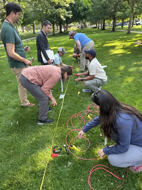 Workshop participants teach other participants how to install geophones for a seismic refraction survey -- after they learned it themselves.
![[creative commons]](/images/creativecommons_16.png) Overview
Overview
Geophysics methods can be applied to a wide range of societally important topics, from natural hazards and groundwater resources to forensics and engineering. They provide a powerful way to engage students in Earth science and allied fields and prepare them for a wide range of possible careers.
This workshop provides the foundation for Earth science instructors to integrate near-surface geophysics instrumentation and methods into their undergraduate courses — from introductory to majors-level. Featured methods are ground penetrating radar (GPR), seismic refraction, electrical resistivity, and real-time kinematic GPS/GNSS surveying. Participants will all learn the basics of GPS/GNSS and focus more heavily on one of the other three methods (and have a lighter introduction to the other two).
The workshop combines field-based hands-on time and classroom time. Participants will gain experience with the GETSI (GEophysics Tools for Societal Issues) teaching modules and plan for implementing the resources into their own teaching.
These types of geophysical instruments are available for loan through the EarthScope Geophysics Field Education program, so participants have the opportunity to borrow equipment after learning how to use them.
Attendees
Participants of the 2022-2025 near-surface geophysics teaching workshops (ex. 2025 workshop) have already learned this content. Please contact the email below if you have questions.
Travel and Costs
Colorado School of Mines is located in Golden, CO on the western side of the Denver metropolitan area. The workshop will provide hotel accommodation during the workshop and up to $750* reimbursement towards travel expenses** (flights and ground transportation).
*Travel support must go to US citizens/permanent residents or people at US institutions. If you do not qualify for travel support but are interested in attending and can pay your own way, please contact the email below.
**If the workshop is canceled for reasons outside EarthScope's control ("force majeure"), expenses already incurred cannot be reimbursed.
Expectations
- Adhere to the EarthScope Code of Conduct
- Attend two preparatory virtual meetings (~1 hour each) in late June (although real-time attendance is preferable, this will be recorded for anyone unable to attend at the time)
- Attend the entire in-person workshop (8:00 am Tuesday July 7 - 5:30pm Thursday July 9)
Goals
Participants will:
- Be able to design and conduct a geophysics survey using two or more near-surface methods (ground penetrating radar, seismic refraction, electrical resistivity, GPS/GNSS)
- Be able to process the resulting geophysics data
- Be able to articulate how the method/s can be used to address societally-relevant geoscience research questions
- Practice teaching a geophysics method to others
- Make implementation plans for teaching the method/s in their own course/s
Micro-credential
- Proficiency certifies that participants have developed intermediate-level skills or competencies relevant to the course content. In this case, learning to design and conduct geophysical surveys (GPR, seismic, electrical resistivity, and/or GPS/GNSS), process the data, and interpret the results in the context of addressing real-world geoscience topics.
- You can showcase the credential on platforms like LinkedIn, your CV, or personal website.
- After the workshop, if you use near-surface geophysics instruments in your undergraduate teaching and complete a short reflection form, you can earn the Mastery-level of the credential.
Leadership
Instructors
- DJ Bustos (EarthScope Consortium)
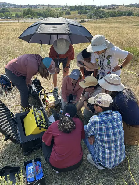
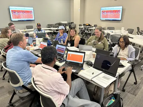 Workshop participants work on GPR data processing.
- Galen Kaip (EarthScope Consortium)
- Anuradha"Maha" Mahanama (Rust College)
- Lawrence Malinconico (Lafayette College)
- DeeDee Okamoto (EarthScope Consortium)
- Beth Pratt-Sitaula (EarthScope Consortium)
Sponsors
- NSF National Geophysical Facility operated by EarthScope Consortium
- Colorado School of Mines Geophysics Department
- National Association of Geoscience Teachers
Questions
Contact Beth Pratt-Sitaula (beth.pratt-sitaula@earthscope.org)