Montana Geoheritage Project
David Mogk, Department of Earth Sciences, Montana State University

![[creative commons]](/images/creativecommons_16.png)
What is 'Geoheritage'?

![[reuse info]](/images/information_16.png)
The National Park Service defines America's Geoheritage as: "Geologic heritage encompasses the significant geologic features, landforms, and landscapes characteristic of our Nation which are preserved for the full range of values that society places on them, including scientific, aesthetic, cultural, ecosystem, educational, recreational, tourism, and other values. Geoheritage sites are conserved so that their lessons and beauty will remain as a legacy for future generations."
Why Geoheritage Sites?

- Conservation and Preservation--The quality of life we enjoy in modern society is largely dependent on use of natural resources to sustain our personal and communal lives: energy, mineral, water, and soil resources. The long-term health of humanity requires that we seek wise and sustainable ways for society to use our limited resources on Spaceship Earth. Conservation is the means for humanity to demonstrate good stewardship of Earth for the use and enjoyment of future generations. However, there are also those special places on Earth that are unique and irreplaceable. These must be protected from indiscriminate use (e.g., resource extraction, sampling, development of infrastructure). Preservation of these special sites provides protection from human disturbances. Natural features we see at the surface of the Earth today represent the culmination of aeons of natural history and processes. It is a rare opportunity to be able to see first-hand the products of these natural processes, and consequently, these sites must be preserved for research, education, and enjoyment of future generations. Given the constraints of space and time, these sites are irreproducible in the context of human experience. In this context, preservation of the geosphere is every bit as important as preservation of the biosphere. "Geodiversity refers to the variety of the geological and physical elements of nature, such as minerals, rocks, soils, fossils and landforms, and active geological and geomorphological processes. Together with biodiversity, geodiversity constitutes the natural diversity of planet Earth" (International Union for Conservation of Nature). Geoheritage sites may include:
- One-of-a-kind natural features, entire landscapes, outcrops, rock, mineral or fossil locations that need to be preserved for exploration and discovery by future generations. Direct observation of natural phenomena provides important insights about the operation of the Earth system... "The field is where the truth resides; it is the essential core of geology. Models are essential figments of the imagination which must be tested by observation. Those who do no field work and do not gather data will never understand geology (John Dewey, in Butler, 2008)."
- Some locations are linked to the development and evolution of the geosciences as a discipline (e.g., location of type sections of rock formations, outcrops that provide the "smoking gun" of evidence for geologic processes such as the K-T Boundary).
- Geoheritage sites may mark locations of human interactions with nature--such as locations of resource development (minerals, energy, soil, water), or as humanity impacts or is impacted by natural hazards. Land owners, land managers, and government agencies may not be aware of the rich natural and cultural resources that are present.
- See the article, Classic Geologic Outcrops: Preservation and Future Accessibility–Marjorie Chan and Diane Kamola, GSA Today, vol 27 # 11, November 2017, as an indication of the importance of preservation of classic geologic outcrops to the future of the geosciences and geoscience education.
- Education--More people in the United States choose to visit natural parks, museums, aquariums and science centers than attend professional sporting events (attributed to NSF; see Center for Advancing Informal Science Education)! Annually, millions of people visit National Parks and Monuments managed by the National Park System (see Annual Visitation Highlights). The American Alliance of Museums Museum Facts reports: "There are approximately 850 million visits each year to American museums, more than the attendance for all major league sporting events and theme parks combined (483 million in 2011)."
- These "free choice" learners actively seek out experiential learning that makes connections to their personal lives and that also supports life-long learning. "Informal science education" is voluntary, self-directed, and lifelong. It is learning that provides an experiential base and motivation for further activity and learning. NSF's Informal Science Education (ISE) program supports projects in which "learning is... motivated mainly by intrinsic interests, curiosity, exploration, manipulation, fantasy, task completion, and social interaction. This informal learning can be linear or nonlinear and often is self-paced and visual- or object-oriented" (National Science Foundation, 1997, p. 8, NSF #97-20).
- In the geosciences, it is the tradition of geologists to take field trips to these iconic sites; the dictum "He who sees the most rocks makes the best geologist" (H.H. Read, 1940) holds true today. K-12 class field trips, collegiate course and field camp trips, professional society field trips all rely on access to these special places for continuing geoscience education. Field instruction is fundamental to geoscience education. (See Mogk and Goodwin, 2012, Learning in the field: Synthesis of research on thinking and learning in the Geosciences, Geological Society of America Special Papers 2012;486;131-163 (volume can be purchased at the GSA Bookstore).
- There is a real need to identify, characterize, and make accessible geoheritage sites of national to local interest, to attract, inspire and support the success of future natural scientists; to support the continuing education of professional geoscientists in formal and informal instruction; and to inspire a sense of awe and wonder about Earth and its systems for the general public.
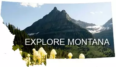
 Get Lost in Montana
- Sustainable Economic Development--Geotourism can be a major economic driver. The Outdoor Industry Association reports that outdoor recreation economy generates $887 BILLION in consumer spending annually, 7.6 million American jobs, $65.3 billion in federal taxes, and $59.2 billion in state and local taxes. Geoheritage sites can serve as a portal to engage the public and encourage them to visit (by design or serendipitously) the natural wonders around us! The Get Lost in Montana! campaign, sponsored by the Montana Department of Commerce is one example of how to promote geotourism.
The Montana Geoheritage Project--Get Outside and Experience for Yourself!
- MT Geoheritage Sites module--use this website as a guide to plan your next vacation.
- Augusta-Choteau area of the Rocky Mountain Front in Montana. This website provides an introduction to the geographic setting, bedrock geology (stratigraphy and structural geology), paleontology (famous fossil site at Egg Mountain, but also including invertebrate and mammalian paleontology), surficial geology (glaciated landscapes, river systems), climate and climate change, agriculture, topical issues (e.g., energy exploration, wilderness areas), and cultural heritage (the writings of Ivan Doig connected to this landscape).
- Geoheritage of the Beartooth Mountains: Traversing 4.0 Billion Years of Earth History. This website includes field guides for a trip around the Beartooth Mountains from a) Livingston to Columbus MT including the West Fork and main Boulder River areas; b) Columbus to Red Lodge MT, including the Stillwater River valley; c) Red Lodge to Cooke City MT over the Beartooth Highway; and d) Cooke City through the northern margin of Yellowstone National Park to Gardiner MT, and then north to Livingston MT via Paradise Valley. A comprehensive Geologic History of the Beartooth_Mountains is included along with an extensive Bibliography of scientific journal articles on the geology of this area.
- MT Trail Guides module--We developed step-by-step guides to popular hiking trails in the Bozeman area. Plan to take a day hike to;
- Sacagawea Peak and walk through layers of sedimentary rocks that include diverse invertebrate fossils (algal mounds, corals, brachiopods and more), geologic structures that formed through Laramide and Sevier style deformation, and glacially sculpted landscapes that continue to evolve through modern surficial processes.
- Hyalite Peak, where you will walk through volcanic deposits very similar to modern day Mount St. Helens eruption; and
- Bear Basin near Big Sky, where you will cross the range boundary Spanish Peaks fault into the deep crustal rocks (from depths as much as 30 km/20 miles!) and that are among the oldest rocks on the North American continent dating back to 3.5 billion years!
- MT Road Logs module: we've selected ~50 of our favorite road logs that are used as guides to explore a variety of geologic features; these road logs are typically used by professional geologists on field trips, as guides to geologic course field trips and field camps, but they are also accessible to the interested public.
The Global Geopark Network
The Montana Geoheritage Project is being developed to follow the philosophy and guidelines of the Statutes of the International Geoscience and Geoparks Programme, a co-operative venture with the International Union of Geological Sciences (IUGS), and the UNESCO Global Geoparks.
Geoheritage in the United States

The National Park Service in collaboration with the American Geosciences Institute has published the booklet America's Geologic Heritage an Invitation to Leadership. "America's geologic heritage arises from the features, landforms, and landscapes characteristic of the United States, which are conserved in consideration of the full range of values that society places on them,so that their lessons and beauty will remain as a legacy for future generations".
Every state in America has a state geological survey, and these agencies variably provide links to sites of great geologic interest in each state. See the Association of American State Geologists (AASG) for links to the geological surveys in each state.
The National Academy Press has published a report on America's Geologic Heritage–Invitational Workshop sponsored by the American Geosciences Institute (AGI), the Geological Society of America (GSA), the U.S. Geological Survey (USGS), the National Park Service (NPS), and the Colorado Geological Survey (CGS).
The National Academy of Science/National Research Council sponsors the U.S. Advisory Group is exploring topics of Geoheritage in the United States and its intersections with Global Geoparks.
The Geological Society of America has developed the GSA Position Statement on Geoheritage that affirms the importance of conserving geoheritage sites in support of the geosciences.
Geoheritage in Michigan
Keweenaw Geoheritage--Developed by Bill Rose, Erika Vye and colleagues at Michigan Tech. "This website is aimed at communicating the strong Geoheritage of the western UP, including the Keweenaw Peninsula and Isle Royale. We aim to reach any reader, and to help them understand:
- What is geoheritage?
- How does Earth Science guide us and influence our living and culture?
- What are the elements of geology here?
- What are the places that teach us the Earth history here?
- How does the Keweenaw window into Earth's history contribute to our world view?"
Geoheritage in West Virginia
The Appalachian Geopark is in planning stages led by Dr. Robert Burns, West Virginia University, and Dr. Jasmine Moreira, Ponta Grossa State University, Praça Santos Andrade, s/n - Ponta Grossa - PR, Brazil. See descriptions at:
- The Appalachian Geopark Initiative--Facebook page
- US Geopark Heritage: Rivers, Rail, Karst, Coal and People at the Appalachian Geopark of West Virginia--Burns et al., 2017, GSA Annual Meeting abstract 93-6, Seattle, WA.
- The Appalachian Geopark Aspiring Project, West Virginia, USA: Rivers Rail, Caves, Coal and People --Burns et al., 2017, European Geoparks 14th Conference.