For the Instructor
These student materials complement the Coastal Processes, Hazards and Society Instructor Materials. If you would like your students to have access to the student materials, we suggest you either point them at the Student Version which omits the framing pages with information designed for faculty (and this box). Or you can download these pages in several formats that you can include in your course website or local Learning Managment System. Learn more about using, modifying, and sharing InTeGrate teaching materials.Density of People and Property Exercise
Exercise
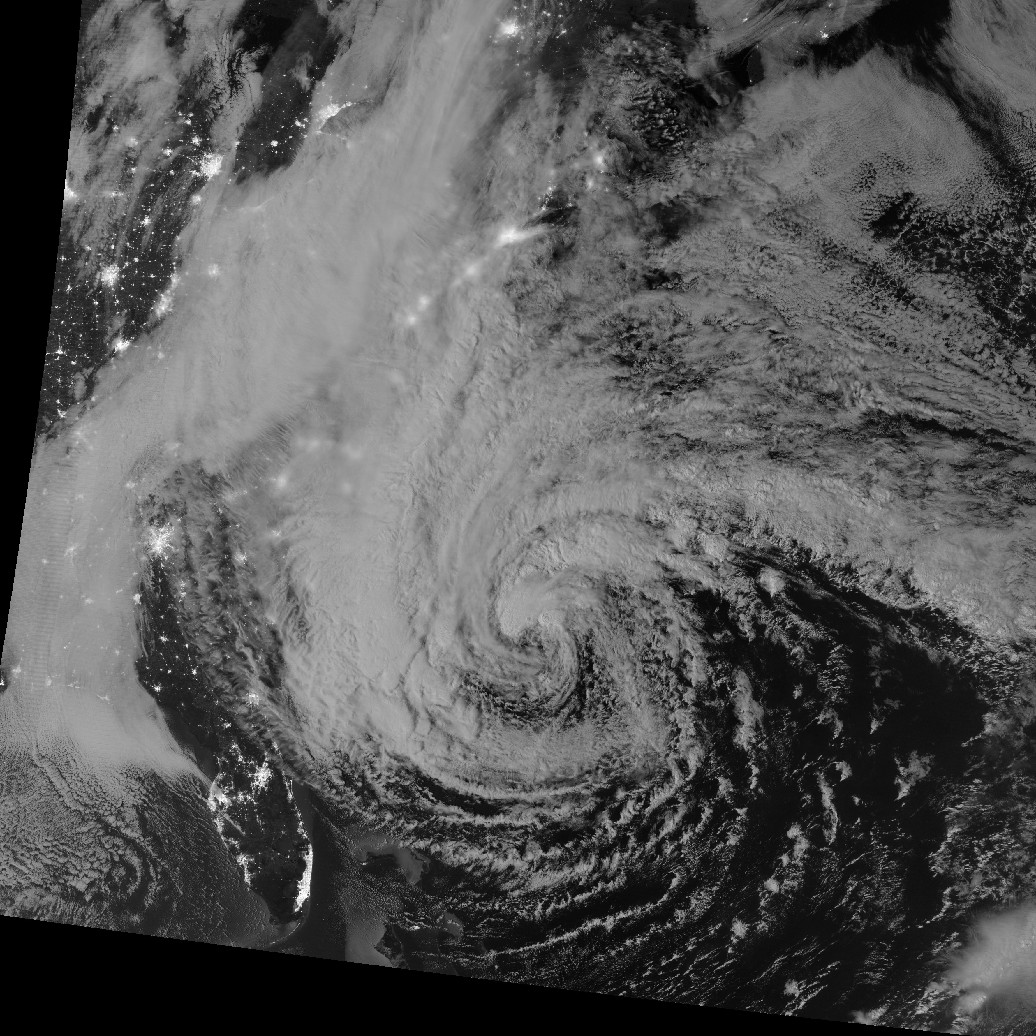
Combining hazard information on top of these night lights can help determine exposure to a specific hazard. For example, the nighttime satellite image below shows both Hurricane Sandy (the large swirl of clouds near the center) and night lights from cities in eastern North America. Because Hurricane Sandy was so large, many major cities (bright spots on the map) were exposed to its wind and waves. To help you identify these cities, the satellite image is overlaid on top of a map of much of the eastern seaboard of the United States (Florida is in the lower left; New York City is in the middle, towards the top).
 Figure 10.14: Nighttime image of Hurricane Sandy, with lights of major cities on the U.S. east coast visible through its swirling clouds, overlaid on top of a map of the U.S. eastern seaboard.
Credit: NASA:Sandy and OpenStreetMap http://www.openstreetmap.org/#map=7/39.842/-75.377
Activate Your Learning
Question 1 - Essay
This exercise is not for credit but the understanding is critical to the Module Summative Assessment.
Using the satellite image and an interactive map of the eastern United States, identify three cities (bright spots) that were beneath Sandy's circulation (evident here as a swirl of clouds) when this picture was taken. To identify specific cities, use the above satellite image overlay to identify the names of states that contain these cities. Then pan and zoom on the interactive map of the eastern United States to find the names of these cities.
Identify three cities (bright spots) that were beneath Sandy's circulation (evident here as a swirl of clouds) when this picture was taken.
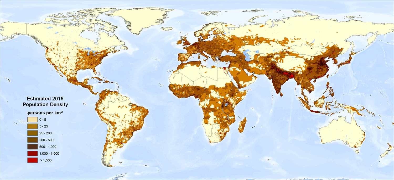
While night light maps can be helpful tool for evaluating exposure to coastal hazards in more developed countries such as the United States, they are not always an appropriate measure of the density of people and property. Compare the map below of global population density with the above night light map.
Question 2 - Short Answer
Which continents have high population density, but dark night lights?
Question 3 - Essay
What implications might this have for assessing exposure of these places to coastal hazards?
 Figure 10.14 (repeated): Global population density.
Credit: United Nations Environment Programme (UNEP)

