
Using Audio to Visualize Scientific Concepts
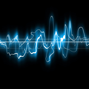
The use of sound to display data is a field of active research that builds upon the human ability to detect patterns within sound. Sonification, or the use of sound to convey information via non-speech audio, is of particular value for detecting patterns in data that are complex or involving a time series. Geophysicist Dave Engebretson of Western Washington University has developed a collection of sonifications of geoscience data for use in the classroom. Below we present a background on the use of audio to visualize scientific concepts within the context of teaching and learning, along with a collection of examples and teaching resources.
Scientific concepts
For a comprehensive description of the following concepts and a general introduction to the field of sonification, see The Sonification Handbook.
- Auditory display refers to all aspects of a system used to compile and present information via sound (e.g. the speakers, the setup, the system for gathering and processing sound, etc.)
- Sonification is a type of auditory display that uses non-speech audio to convey information.
- Audification is a type of sonification. Audification conveys data that is in a sequence through sound, allowing for patterns such as periodicity to be recognized.
- Parameter mapping sonification is a commonly used method of sonification in which data are assigned attributes and these are 'mapped' to achieve an auditory output that contains all of the data.
- Model-based sonification is a more recently developed technique focusing on interactivity, where sound models are created with the data and the user explores the data through interacting with these models.
Incorporating sonification into the classroom: Engebretson Collection
Geophysicist Dave Engebretson of Western Washington University has developed a collection of audio visualizations of geoscience data for use in the classroom. Dr. Engebretson describes one example of the use of audio files to understand and interpret data in this story that was broadcast on National Public Radio's All Things Considered, Geophysicist shares a song of Earth's polarity. Various auditory displays allow for a range of user interaction. At one end of the spectrum, users simply listen. Adding the ability to stop, rewind, and replay increases the degree of interactivity. On the other end of the spectrum, users actively select and change parameters of the display. Below are example audio files from Dr. Engebretson.
Tidal heights at Friday Harbor, San Juan Island, Washington
Tidal heights are mapped into tones. High tides are mapped to high frequencies and lower tidal heights are low frequencies. Tone bursts occur every hour of Earth time.
85 million years of Earth's magnetic reversals
1 million year of Earth time is 1 second of audio time. Tones are based on the length of a polarity interval. Short intervals are mapped into high tones, long intervals are mapped into low tones.
Topographic flyover along the equator
Low tones represent deep oceans and high tones represent high mountains.
Additional resources:
- Creating auditory graphs. The Sonification Lab at Georgia Technology Institute describes methods for developing Auditory Graphs.
- Visualizing Seismic Waves for Teaching and Research
As a part of this 2011 online workshop, a couple of experts presented on the use of sonification to help their students learn about seismic activity. Video of this session and the presentations that were given are available on the program page. The workshop website also boasts links to teaching activities and visualizations related to geophysics. - Georgia Institute of Technology Sonification Lab
- Thomas Hermann's research on Sonification
- International Community for Audio Display (ICAD)