Isopach Maps
Summary
![[creative commons]](/images/creativecommons_16.png)
Context
Audience
200-level undergraduate course, "Introduction to Geologic Structures." This course is a pre-requisite for most upper-level undergraduate geoscience courses in the core curriculum, including Structural Geology. It has a pre-requisite of an introductory level Geology course.
Skills and concepts that students must have mastered
Students must understand and be able to "read" contour maps, such as topographic maps. Familiarity with the definitions and functions of isopachs and structure contours are helpful, but we also review these during the activity.
How the activity is situated in the course
This series of short exercises follows a few weeks of working with topographic maps and with structure contour maps of simple geological structures, such as homoclinal dipping beds. Students are therefore conversant with the concept of contour maps. During the class period immediately preceding this one, I lecture on topographic, isopach, and structure contour maps. These exercises are students' first experiences actively using isopach maps.
Goals
Content/concepts goals for this activity
- Students will be able to "read" isopach maps
- Students will be able to sketch isopach maps of geometrically simple features
Higher order thinking skills goals for this activity
Students will understand how isopach maps differ from topographic maps and from structure contour maps
Skills goals for this activity
3D spatial visualization
Description and Teaching Materials
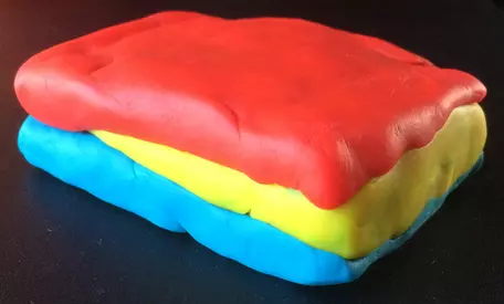
I build three Play-Doh models for this series of short exercises:
- A sedimentary wedge, pinching out between two other layers
- Erosional remnants sandwiched between continuous sedimentary layers
- A laccolith, the top of which is partially exposed by erosion
Activity 1: sedimentary wedge
- construct an isopach map of the wedge-shaped unit
- construct a structure contour map of the base of the top unit
We discuss how these maps are similar and how they are different, and why. I answer any student questions, or, in some cases, direct the small groups to figure out the answer to student questions.
I then show some examples of isopach maps of sedimentary wedges and discuss the tectonic stories/events they illustrate.
Activity 2: erosional remnants

Students will see erosional remnants of sedimentary strata on an upcoming field trip. I will refer back to this activity on the trip.
Activity 3: laccolith
I show a geologic map and an isopach map of a laccolith, side by side, and ask the small groups to discuss why the zero thickness isopach line is outside of the outcrop pattern of the laccolith on the geologic map. I also ask why the isopach map shows one exceedingly thick zone.
When a student has correctly answered these questions, I show them a Play-Doh model of the laccolith and remove the "sedimentary" layer that partially covers the "laccolith."
Students have seen a laccolith on a previous field trip, and I remind them of this.


Science of Learning: Why It Works
Three-dimensional models can help to improve students' understanding of geological phenomena. Physical models, such as playdough models, serve as analogies to geological features and geologic maps. Analogies support the development of spatial thinking skills by allowing the student to draw from their knowledge and apply it to new cases (e.g., Gentner 1983). For example, students can reason from what they can experience when carving off pieces of playdough to how erosion will reveal geological structures). Analogical learning also applies to "mapping" -- that is, relating -- the features of models onto real world phenomena (e.g., this layer of playdough corresponds to a layer of sandstone). Physical models provide analogies to real-world phenomena, support cognitive offloading, and promote spatial accommodation.
Practice constructing spatial analogies can help students develop the mental models that allow them to recognize new cases of familiar concepts in the field. When instructors provide accurate physical models of geologic features, students can self-assess their understanding by comparing their mental model -- or their own physical model -- to the instructor's physical model. When students make their own physical models, these models serve as a means of "inscription," in much the same ways that mapping and sketching do: they allow for students to record their conceptual understanding of a natural phenomenon (Mogk and Goodwin, 2012). However, unlike mapping and sketching, a playdough model allows for this record to be three-dimensional, like the phenomenon itself, which can reduce the cognitive demands inherent in the process of inscription by reducing the need to generate a 2D representation of 3D space (Newcombe, 2012). In addition, physical models support spatial accommodation: when a student compares their (mental or physical) model of a phenomenon or region to their instructor's model and recognizes a difference between the models, the student is prompted to revise their mental model (Davatzes et al., 2008). When the change required is spatial the student may use the feedback directly to revise the model. When the change is significant, the student may need to completely discard their old model and construct a new one. Playdough models of geological structures can thus serve as the basis for improved mental models.
Teaching Notes and Tips
Tilting any of these models can help to illustrate the difference between topographic contours and isopach contours, if students appear to be confounding them.
Assessment
Students complete several homework and lab exercises incorporating isopach maps.
References and Resources
Resources
This exercise builds on previous activities in the course, including Introduction to structure contours.
References
Davatzes et al. (2018). Learning to form accurate mental models. Eos, 99, https://doi.org/10.1029/2018EO091643. Published on 07 February 2018.
Gentner, D. (1983). Structure-mapping: A theoretical framework for analogy. Cognitive Science, 7(2), 155–170.
Mogk and Goodwin (2012). Learning in the field: Synthesis of research on thinking and learning in the geosciences, in Earth and Mind II: A synthesis of research on thinking and learning in the geosciences, edited by Kim A. Kastens and Cathryn A. Manduca. GSA Special Paper 486:131-163. DOI: 10.1130/2012.2486(24)
Newcombe, N. S. (2012). Two ways to help students with spatial thinking in geoscience. Geological Society of America Special Papers, 486, 85-86.