
GPS Treasure Hunt
This material is replicated on a number of sites as part of the SERC Pedagogic Service Project
Summary
Learning Goals
- How to use a GPS
- Teamwork!
- Different types of building stone
Context for Use
Teaching Materials
Before the activity, you'll want to create sheets with directions for the student groups.
- If the students are doing the activity on their own time, you can give all groups the same sheet, but if they're all doing it at the same time, they'll need separate sheets to split up the groups and require more of the students to actually use the GPS reciever and make identifications.
- Depending on the nature of the class, decide what the students will be identifying (trees or building stones work pretty well).
- Choose six to eight identification stops (depending on the number of students in the groups you'll assign) with appropriate trees or building stones on campus.
- Mark the identification stops and their coordinates on a campus map
- To make multiple direction-sheets, work out the bearings among the identification stops with a protractor and work out as many routes as you can that cover all of them.
Once it's time to start the activity, organize the students into teams of three or four (depending on how many GPS units are available).
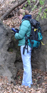
Start by teaching students to use GPS recievers. They need to be familiarized with the global positioning system and with the ideas of coordinates and bearings before this exercise.
- Have each student in each group use the GPS receiver to obtain coordinates for your starting spot and write them down. After they are done, have someone volunteer coordinates.
- Now is a good time to briefly review how much error there is likely to be in these coordinates and factors that will make it difficult to make measurements, such as proximity to trees and buildings (which is where they'll need to be to make identifications, unfortunately).
- Time to try using the GPS as a compass. Have the student groups work together to get bearings to a particular landmark.
- Then, give the students bearings that you previously worked out to another landmark, and see if they can point out the correct landmark.
Give the students sheets of directions (different sheets for different groups if possible) and insist that they must take turns using the receiver. Ideally, you'll have twice the number of identification stops as students per group, so each student gets to use the receiver twice.
- If this activity occurs during class time or lab time, you'll want to wander between various groups and make sure that they understand what they're doing.
- The direction sheet should consist of bearings and either coordinates or a description that tells them when to stop (alternatively, mark the stop with a small piece of bright flagging). Tell them what to identify and have them give either the coordinates or a description of the stop which may include the name of a building (whichever they didn't get on the sheet).
- At the last stop (possibly not an identification stop if you've got a good hiding spot on campus), have the team pick up a winning ticket for an edible prize, to be redeemed at the next class period.
Teaching Notes and Tips
The biggest chunk of work will be the direction sheets. Making sure that students take turns but don't get lost during the actual activity is rather important. If they misidentify a stop, the bearings that lead them to the next one won't work!
A follow-up discussion for an activity could include having them work out some of the bearings they used on a map of the campus.
Assessment
Scoring: In addition to the snack, you could offer an extra prize for all groups who turn in 100% correct answers.
You may want to require the students to get a certain number of answers right for a grade.