Student Materials
For the Instructor
These student materials complement the Long-term Spatial Transformations of the Glacier Basin System Instructor Materials. If you would like your students to have access to the student materials, we suggest you point them at the Student Version which omits the framing pages with information designed for faculty (and this box).
Module 2: Long-term Spatial Transformations of the Glacier Basin System
Pre-Unit prep:
Review Module 1 Unit 1 content. Module 2 is designed to be taught after Module 1, but could be taught after review of Module 1 Unit 1 review, and shortened content from Module 1 items as needed based on other classroom prep.
Overarching goals from Module 1 Unit 1:
- Develop a sense of place for the Greenland Ice Sheet.
- Understand glacier basin system components and seasonal changes.
- Connect surface, englacial and subglacial features and processes.
- Understand changes that occur over decadal timescales in a glacial basin system.
Unit 1: Reconstructing Past Ice Margin Positions
Introduction to long-term changes of the Greenland Ice Sheet
Note: Pre-Class Readings for Part 2 (see below)
Video: Introduction to long-term climatic changes of the earth system and Greenland Ice Sheet WGRZ-TV-The science of climate change
Part 1: Glacial Landforms and Ice Margins
Students start with a point of speculation/ hypothesis making re: where are current and past moraine locations, interpretation of landscape features, estimation of age based on modern retreat rates. Students explore the glacial landforms of west Greenland with images/360 IE.
- Image Slide Deck: Glacially formed landscape features on the west Greenland ice sheet margin Mod2 Unit1 Part1 Glacial Landforms Greenland.pptx (PowerPoint 2007 (.pptx) 51.4MB Nov16 22)
- Video: Visiting Kangerlussuaq Greenland (up to 2:51 min) by Dave Clark
If Using 360 IE
- 360 IE: Module 2, Unit 1, Part 1- Glacial Landforms-Visually Exploring Past Ice Margin Retreat
If NOT Using 360 IE
- Image Slide Deck (same as above): Module 2 Unit 1 Part 1 Glacial Landforms of Greenland
Part 2: Proxy Records and Retreat Timing
Students learn about how ice cores, lake sediment cores, and age-dating of rock surfaces can be used to determine the timing of glacial advance/retreat and extent of the ice sheet. Students then explore observations/evidence of ice margin retreat thru multiple time periods (Early Holocene, Neoglacial, Little Ice Age, present) from Greenland datasets.

![[creative commons]](/images/creativecommons_16.png)
Pre-Class: Reading: Students read assigned sections of the Lesnek et al., 2020 and Briner et al., 2010 (2 groups splitting 1st half/2nd half of each paper)-see Resources at bottom
Videos: Students watch videos on the combined use of ice cores and radar imaging to determine the age of the Greenland Ice Sheet. ClimateCentral-Drilling Back to the Future: Climate Clues from Ancient Ice on Greenland and NASA Greenland's Ice Layers Mapped in 3D
Discuss suite of climate and ice sheet margin proxies (include sediment cores, cosmogenic nuclides, ice cores) and explore (1-2) in-depth. Groups of students investigate a specific proxy and then Jigsaw to share out about what they found.
Ice margin location and ages via proxy data and direct measurements
- Image Slide Deck: Use of proxy data/tools (e.g. sediment cores, ice cores, cosmogenic nuclides, glacial landforms) to reconstruct position and timing of glacier margin Mod2 Unit1 Part2 Proxy Margin Reconstruction.pptx (PowerPoint 2007 (.pptx) 53.2MB Nov30 22)
- Reading: Students discuss the Lesnek et al., 2020 and Briner et al., 2010 (2 groups splitting 1st half/2nd half of each paper = 4 groups total), and then Jigsaw with a focus on key Figures/Maps.
- Exercise/QGIS: Developing Proxies for Ice Margin Advance/Retreat Mod2 Unit1 Part2-3 Ice Margin Proxies Exercise STUDENT.docx (Microsoft Word 2007 (.docx) 523kB Oct5 23)
- Video: Ice Coring at EastGRIP-Climate research in ice caves in Greenland (360 tour) and Ice core processing at NICL
- Ice Core: GISP2 d18O Isotope Data Mod2 Unit1 Part2 Ice Core GISP2 d18O Timeseries STUDENT.xlsx (Excel 2007 (.xlsx) 82kB Feb22 22) from Vinther et al., 2009
- Video: Lake Sediment Records-Ancient Greenland warmer than previously thought
- Sediment Core: Loon Lake (tab) Mod2 Unit1 Part2 Sediment Cores IceBoom Loon Timeseries Briner 2010 QSR STUDENT.xlsx (Excel 2007 (.xlsx) 31kB Jan5 23) from Briner et al., 2010
- Video: Cosmogenic Exposure Dating-Welcome to the NSF UVM Community Cosmogenic Laboratory

- Exposure Ages: Kangerlussuaq region Be10 Ages uploaded via a csv-table into QGreenland Tables_Baffin_Bay_Young.csv (Comma Separated Values 8kB Feb23 22). Students also calculate the average and standard deviation of ages from various glacial landforms in Excel and compare with figures from Lesnek et al., 2020, Young et al., 2020, and Levy et el., 2012
- Maps: Ice sheet extent based on glacial landforms (moraines, erratics, tarns, till, striations, trim lines) and timing of retreat by terrestrial cosmogenic nuclide exposure ages (see Image Slide Deck from above)
Part 3: Interpreting Proxy Records
Students work together to interpret an additional proxy record using a specific dataset. Three proxy methods (exposure ages, ice cores, and sediment cores) to jigsaw for the class.
- Dataset: Be10 exposure ages from bedrock/boulders from west Greenland margin (use QGreenland, see papers in References)
- Dataset: Lake sediment cores from glacial lakes along west Greenland margin (MS/LOI-Iceboom and Fishtote Lake from Briner et al., 2010 (same file as above), Chironomid Temps-North Lake from Axford et al., 2013 Mod2 Unit1 Part3 Sediment Core NorthLake Chironimids Axford QSR 2013 STUDENT.xlsx (Excel 2007 (.xlsx) 9kB Feb23 22))
- Dataset: Ice Core DYE3 d18O Isotope Data Mod2 Unit1 Part3 Ice Core DYE3 d18O Timeseries STUDENT.xlsx (Excel 2007 (.xlsx) 26kB Feb22 22)
- Utilize the Arctic-wide Holocene paleoclimate review for interpreting your chosen records in the broader N.H. context: Briner, J.P. et al., 2016. Holocene climate change in Arctic Canada and Greenland. Quaternary Science Reviews, 147, pp.340-364. https://doi.org/10.1016/j.quascirev.2016.02.010
What we learned:
- Estimate the ice margin position over thousands of years using proxy data.
- Calculate rates of ice sheet margin change over time and space.
References and Resources
Ice Cores
Vinther, B., Buchardt, S., Clausen, H. et al. Holocene thinning of the Greenland ice sheet. Nature 461, 385–388 (2009). https://doi.org/10.1038/nature08355
Kobashi, T., et al., 2011. High variability of Greenland surface temperature over the past 4000 years estimated from trapped air in an ice core. Geophysical Research Letters, 38(21). https://doi.org/10.1029/2011GL049444
Sediment Cores
Briner, J.P. et al., 2010. Using proglacial-threshold lakes to constrain fluctuations of the Jakobshavn Isbræ ice margin, western Greenland, during the Holocene. 29(27), pp.3861–3874. http://www.sciencedirect.com/science/article/pii/S0277379110003276.
Axford, Y., Losee, S., Briner, J.P., Francis, D.R., Langdon, P.G. and Walker, I.R., 2013. Holocene temperature history at the western Greenland Ice Sheet margin reconstructed from lake sediments. Quaternary Science Reviews, 59, pp.87-100. https://doi.org/10.1016/j.quascirev.2012.10.024
Carrivick, J.L. et al., 2018. Ice-dammed lake and ice-margin evolution during the Holocene in the Kangerlussuaq area of west Greenland. Arctic, Antarctic, and Alpine Research, 50(1), pp.1–13. https://doi.org/10.1080/15230430.2017.1420854
Cosmogenic Exposure Dating
Young, N. E., Briner, J. P., Miller, G. H., Lesnek, A. J., Crump, S. E., Thomas, E. K., et al. (2020). Deglaciation of the Greenland and Laurentide ice sheets interrupted by glacier advance during abrupt coolings. QSR, 229, 106091. http://doi.org/10.1016/j.quascirev.2019.106091
Lesnek, A. J., Briner, J. P., Young, N. E., & Cuzzone, J. K. (2020). Maximum southwest Greenland ice sheet recession in the early Holocene. Geophysical Research Letters, 47, e2019GL083164. https://doi.org/10.1029/2019GL083164
Levy, L.B. et al., 2012. Age of the Orkendalen moraines, Kangerlussuaq, Greenland: constraints on the extent of the southwestern margin of the Greenland Ice Sheet during the Holocene. Quaternary Science Reviews, 52(C), pp.1–5. https://doi.org/10.1016/j.quascirev.2012.07.021
Carlson, A.E. et al., 2014. Earliest Holocene south Greenland ice sheet retreat within its late Holocene extent. Geophysical Research Letters, 41(15), pp.5514–5521. https://doi.org/10.1002/2014GL060800
Original Proxy Data
Proxy data from NOAA-NCEI Paleoclimatology: https://www.ncdc.noaa.gov/data-access/paleoclimatology-data
Proxy data from Arctic Data Center https://arcticdata.io/catalog
Proxy data from Pangaea: https://pangaea.de
Unit 2: Processes of ice margin retreat and elevation/thickness change
Part 1: Processes driving ice margin, elevation, and thickness change
Exploring GIS and an online tool to examine ice edge changes over multiple decades. This exploration should be integrated with discussion of ice sheet mass balance, melt, and ice sheet edge changes across varying environments (e.g., marine-terminating glaciers, land-terminating glaciers, other ice edge regions).
- Videos: Research on past Greenland Ice Sheet extent, and advance/retreat-
- Image Slide Deck: Processes of ice margin retreat and elevation/thickness change Mod2 Unit2 Part1 Processes Ice Margin Change.pptx (PowerPoint 2007 (.pptx) 147MB Nov16 22)
Part 1 exercises use the QGreenland QGIS environment. Follow these instructions to install these tools Mod 1 GIS Setup Instructions.pdf (Acrobat (PDF) 2.3MB Dec8 21)
- Exercise/QGIS: Multi-decadal glacial margin change exploration activity Mod2 Unit2 Part1 GIS Landsat Multidecadal Margin Change Exercise STUDENT.docx (Microsoft Word 2007 (.docx) 405kB Oct9 23)
- GIS: Landsat satellite imagery data files Mod2 Unit2 Part1 Multidecadal Landsat Images.zip (Zip Archive 13MB Feb17 22)
- Interactive Website: https://jmleaglacio.users.earthengine.app/view/greenlandglacierchange A neat tool that students could use to look at image comparisons in (somewhat random) locations all around Greenland
Part 2: Determining Glacier Advance/Retreat from Landforms
Students explore and identify erosional and depositional landforms in ice margin images and based on glacial features determine if ice is advancing or retreating or stable. (These landforms are one way we identify advance/retreat).
- Videos: Reading the Landscape, Signs from Glaciers Past by Dartmouth/IGERT and Meredith Kelly
ArcticDEM Elevation Explorer: https://livingatlas2.arcgis.com/arcticdemexplorer/
- Students identify elevation transects across landform features at the ice margin and elevation change at a specific margin location (e.g., Russell Terminus)
- Exercise: Arctic DEM Explorer tool to identify glacial landform features and measure surface elevation changes Mod2 Unit2 Part2 Arctic DEM Erosional-Depositional Landforms STUDENT.docx (Microsoft Word 2007 (.docx) 498kB Oct9 23)
- In addition, use GoogleEarth Pro to explore and identify recent (tip: select Historical Imagery) erosional and depositional landforms indicating current ice margin changes for close-up views

What we learned:
- Recognize the natural factors that cause glaciers/ice sheets to advance and retreat
- Identify types of erosional and depositional landforms that indicate ice advance, stability, or retreat
Unit 3: Distinguishing between natural climate variability and anthropogenic forcings
Part 1: Historical Glacier Terminus Positions
Pre-class Reading: Roe, Journal of Glaciology, 2011 (first 4 pages) https://doi.org/10.3189/002214311796905640

Students review aerial maps/ imagery of Greenland outlet glaciers (like Jakobshavn or Russell/Leverett) to identify terminus position since the end of the Little Ice Age (~1850) using GoogleEarth.
Leading prompts - What do you notice about the glacier termini? Have they advanced, retreated, or remained stable. What do you think might be the explanation for the changes?
Focus question - Are these observations outside the natural/expected glacial length variations? Students come up with possible methods to answer this question.
Part 2: Glacier Length Change- Natural vs. Anthropogenic Forcing?
Students use satellite imagery of specific outlet glaciers to determine the length of retreat (if any) using the Arctic DEM Explorer. Then, based on the historical observations (Greenland glacier length change dataset), calculate the rate of terminus retreat per decade since the Little Ice Age and compare to the Early-Mid Holocene ice margin retreat (this builds off Mod 2, Unit 1).
- Image Slide Deck: Revisit Natural glacier length variability vs. forced (anthropogenic) from Mod1 Unit2 Part3 Mod 1 Unit 2 Part 3 Basics Glacier Length Variation.pptx (PowerPoint 2007 (.pptx) 30.4MB Dec12 22)
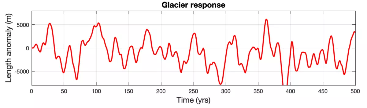
- Discuss how the timing of the glacier's characteristic response time (Tau = h/b) is linked to average thickness (h in m) and accumulation (b in m/yr), which can produce lagged responses to climate forcing based on the glacier's size?
Students use the Greenland glacier length data and rates of change to determine how much of the observed changes are within natural variability vs. anthropogenic warming (assuming pre-Industrial changes are a benchmark for natural rates)?
- Exercise: Natural vs Anthropogenic Glacier Length Changes Mod2 Unit3 Part2 Glacier Length Exercise STUDENT.docx (Microsoft Word 2007 (.docx) 1.4MB Oct11 23)
- Option A: Use Google Earth Pro to determine LIA glacier areas, width, thickness, and average slope
- Option B: Download present-day glacier polygons from GLIMS Glacier Viewer
- Dataset: Greenland glacier length change from Leclercq et al., 2014 Mod2 Unit3 Part2 Leclercq Cryosphere 2014 Greenland Glacier Properties STUDENT.xlsx (Excel 2007 (.xlsx) 942kB Oct11 23)
- Model: Two MATLAB m-files
- ThreeStageModel_PolarPASS_GlacierLength_Sigma.m ThreeStageModel_PolarPASS_GlacierLength_Sigma.m (Matlab File 6kB Mar13 23)
- ThreeStageModel_PolarPASS_GlacierLength_Trends.m ThreeStageModel_PolarPASS_GlacierLength_Trends.m (Matlab File 6kB Mar13 23)
What we learned:
- Differentiate between Natural vs. Human forcings that cause glaciers/ice sheets to advance and retreat
- Determine that the response of glacier/ice sheet margin retreat in Greenland is outside of the natural/expected variations
- Determine that the rates of retreat and thickness change have accelerated beyond historical/proxy levels with continued carbon emissions
Unit 4: Future ice margin response to climate
Driving Question: What is the range of possible futures for the Greenland Ice Sheet size and shape?
Learning Goals: 1) Evaluate how the GrIS future margin depends on the climate scenario path. 2) Examine the expected spatial path of GrIS retreat as it relates to climate, topography, and ice dynamics
Part 1: Climate Scenarios and Greenland's Future
Using images and videos, students consider the current mass changes of the Greenland Ice Sheet and learn about how scientists use scenarios to project the future of the climate and the Greenland Ice Sheet. Students are introduced to the Aschwanden et al., 2019 research in preparation to interact with these data in QGreenland and QGIS.
- Image Slide Deck: Current and future changes of the GrIS Mod2_Unit4_Greenland_Present_Future_Change.pptx (PowerPoint 2007 (.pptx) 540.7MB Mar2 22)
- Reading: Aschwanden et al., 2019 in Science
In the Unit 4 exercise, students begin by calculating the volume of the ice sheet at present and then predict how long it might take for the full ice sheet to melt away. They then consider ice sheet model results for a range of future climate scenarios, reflecting on the most likely scenario based on current global policies and commitments. Using the future ice sheet projections, students examine the spatial patterns of ice sheet change and the possible causes for creation of these patterns. Finally, students consider the wider system changes that may be reflected in this future landscape.
- Exercise/QGIS: Greenland's Future Mod2 Unit4 Part1 Greenland Future Exercise STUDENT.docx (Microsoft Word 2007 (.docx) 994kB Oct9 23)
Part 2: Connecting Greenland with the Global Earth System and You!
Module 2 wrap-up where students consider how the future changes in Greenland impact the human and natural world globally. Consider sea level rise projections, along with precipitation and temperature changes.
If sharing in class, the Instructor can play the videos, or if assigned as homework, students can view the GCM projections of IPCC scenarios and explore the modelling tools below.
- Model/Datasets: GCM model projections of IPCC scenarios
- Video: Present and Future Climate in a Global Model CESM1 by NCAR VisLab
- Video: Air Temperature: CMIP6 EC-Earth Annual 2m Temperature change compared to Pre-Industrial, 1850-1900
- Video: Precipitation: CMIP6 EC-Earth Annual Precipitation change compared to 1981-2010
- Model: CO2 and Temperature The Very Simple Climate Model by UCAR SciEd
- Model: Sea Level Rise: IPCC AR6 Sea Level Projection Tool by NASA
- Model: David Archer's Compilation of AR5 GCM Simulations http://forecast.uchicago.edu/models.html
Think/Pair/Share (here are several suggested prompts):
- How do the changes in Greenland interact with the global Earth system?
- How might these broader changes impact your region locally; in your lifetime and 4 generations from now?
- Beyond the physical environment, how would these changes impact communities, economies, livelihood, geopolitics, and culture?
- How might scientific and technological advancements help mitigate the impacts of these climate changes?
- What actions do you think should be taken at local, regional, or national levels to plan for these changes?
What we learned:
- Evaluate how the GrIS future margin depends on the climate scenario path.
- Examine the expected spatial path of GrIS retreat as it relates to climate, topography, and ice dynamics.
- Explored how broader climate changes will impact local and regional communities over multiple timescales.