
E-STEM Field Course

Summary
Students spend approximately 2 weeks in the Sierra Nevada working on applied projects in geology, hydrology, and ecology with stakeholders from academia, industry, non-profits, and government agencies. Students have the opportunity to practice and master critical field skills; learn about the incredible breadth of career opportunities in environmental fields; and network with potential employers.
Course Motivation
The Environmental-STEM (E-STEM) field course addresses the disconnect between field experience and skill acquisition as professional development. The emphasis on professional development facilitates student recognition of program value in terms of employment opportunities in addition to the outdoor experience which may be particularly important for students from underrepresented groups. For example, surveys of Hispanic students have shown that previous outdoor experience is not a gateway to the geosciences (Stokes and Flessa, 2014). Moreover, many reported that they encountered skepticism when explaining their choice of a geoscience degree to their families. Sharing information on employment opportunities, job security, and starting salaries in geoscience fields will help to convince both students and families that geoscience is a worthwhile profession (Hoisch and Bowie, 2010).
Course Goals
Upon completion of the course, students will be able to:
- Complete a basic hydrological investigation of a watershed
- Construct a geologic history from field observations
- Measure the density, diversity, and distribution of plant species using standard ecological field methods
Course Size
15-30 undergraduate students
Course Format
Field Course
Institution Type
4-year colleges and a community college
Course Context
This course is intended for undergraduate students pursuing environmentally focused degrees (e.g., environmental science, environmental studies, ecology) interested in gaining professional development experience in the field.
Student Selection
Students were pooled from introductory courses at the College of the Atlantic, University of San Francisco, and Mt. San Antonio College. The students applied to this field course in the preceding winter and submitted:
- An unofficial transcript,
- A letter of interest which outlined how participation would help them work toward (achieve) academic, career, or personal goals,
- A sample resume, and
- A letter of support from a STEM faculty member at their home institution.
Selected students were in good academic standing, demonstrated an interest in pursuing a geoscience career, and provided unique skills, perspectives, or knowledge.
Course Content
This E-STEM field course focuses on Geology, Geomorphology, Hydrology, and Ecology and includes approximately 2 weeks worth of field activities that provide students with the opportunity to practice key E-STEM field skills, such as mapping and maintaining field notes, while meeting E-STEM professionals in the field. The field exercises emphasize the ways in which these environmental-related disciplines overlap and present both opportunities and challenges in environmental resource management.
Course Timeline
The following timeline has been constructed from both the 2017 and 2018 field course schedules. Browse all Teaching Activities »
Day 1-2: Southern Sierra Critical Zone Observatory (SSCZO)
- Background: Students are provided with an overview of the geology of California, an introduction to the SSCZO, an introduction to many instruments and why we make efforts to "monitor" (longterm trends), and an introduction to soil.
- Activity: Ground truth water level, Meadow map, compare soil profiles, soil moisture survey, and soil map.
- Stakeholders: Outreach Coordinator and Soil Biochemist Field Manager.

![[reuse info]](/images/information_16.png)
Day 3-5: Yosemite
- Background: Grove restoration, Yosemite land-use, dams in California, dating, geologic hazards.
- Activity: 3 Botany Field observations, glacial scavenger hunt, river restoration project, Reading the Landscape unit of the GETSI Surface Process Hazards Module
- Stakeholders: Seasonal National Park Service Worker, Transportation Coordinator and Planner, Interpretive Ranger, and Park Geologist.
Day 6: McGee Creek
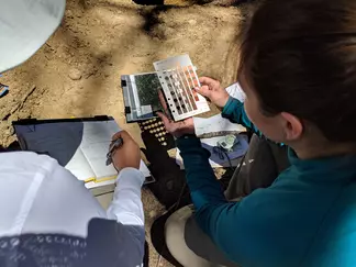
- Background: Introduction to botany including two Botany Field Observations and morphology.
- Activity: Plant Scavenger Hunt and Plant Identification.
Day 7: Panum Crater and Walker Lake Area
- Background: Moraines, CA geologic history and volcanism.
- Activity: Panum Crater Geomorphic Map, Walker Lake Area Canyon Glacial Geomorphology, Botany Field Observation, Botanical Transect Mapping.
- Stakeholder: USGS volcano observatory.
Day 8: Sierra Nevada Aquatic Research Laboratory (SNARL) Hydrology
- Background: Introduction to Hydrology (how rivers work, velocity area method, surveying, stream geomorphology sketching).
- Activity: Intro to Quantifying Stream Discharge and Base Flow, Measuring Stream Discharge and Base Flow in the Field.
- Stakeholder: Hydrologist, SNARL Researchers, and grad students.
Day 9: McGee Creek
- Background: Faults, plate tectonics, and tectonic setting of Eastern California.
- Activity: McGee Creek: Geomorphic History, Botanical Transect Mapping, two Botany Field Observations, Moraine sketch.
Day 10-11: Mono Lake North
- Background: Regional paleoclimate and recent climate change, regional land-use and social history (water management), Mono Lake visitors center/Tuffa, volcanic setting/regional history, Hydrology and Geomorphology.
- Activity: Mono Lake North Synthesis Project and Botany Field Observation

Day 12: Little Poleta and Bristlecone
- Activity: Poleta: Stratigraphy, Poleta: Geologic Map, Ancient Bristlecone Pine Forest Soil, Vegetation, and Bedrock Mapping Activity, Botany Field Observation
Day 13: Hot Creek, Mammoth Community Water District (MCWD)
- Background: Water management and treatment plant tour and an overview of water resources.
- Activity: Groundwater Potentiometric Surface Mapping.
- Stakeholder: MCWD specialists.
Day 14: Mono Lake North
- Background: LA aqueduct and water rights.
- Activity: Sediment Transport, Botanical Transect Mapping, Botany Field Observation.
Assessment
Students are assessed for each field exercise using one or more of the badge rubrics designed for the course.
The final grades were calculated by combining scores for the different student products. One potential weighting scheme is:
- Exercises - 40%
- Field Reports - 50%
- Field Notebook - 10%
References and Notes
References Cited:
Stokes, P.J., Levine, R., and Flessa, K.W. (2014), Why are there so few Hispanic students in geoscience? GSA Today, v. 24, no. 1, p. 52–53, doi: 10.1130/GSATG176GW.1.
Hoisch, T.D., and Bowie, J.I. (2010), Assessing factors that influence the recruitment of majors from Introductory geology classes at Northern Arizona University: Journal of Geoscience Education, v. 8, no. 3, p. 166–176.