Evidence for Plate Tectonics
Description
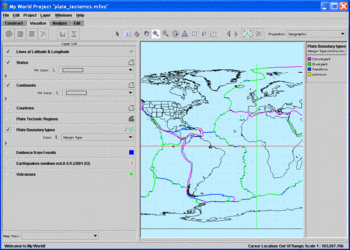
Through the use of the data visualization tool, My World GISTM, you will construct a world map containing evidence to support the theory of plate tectonics. After creating a base map and selecting three different lines of evidence from a built-in data library, you will make selections from the evidence in order to identify relationships among the data. By searching for patterns within fossil, volcano, and earthquake data, you will make an evaluation for the support of the theory of plate tectonics.
This chapter is part of the Earth Exploration Toolbook. Each chapter provides teachers and/or students with direct practice for using scientific tools to analyze Earth science data. Students should begin on the Case Study page.
The EET web site collects no personally identifying information and so is compliant with the Children's Online Privacy Protection Act. The site is constructed with tools that attempt to ensure the broadest possible accessibility in line with section 508 and w3c guidelines.


