
Field trip: Geomorphology and Flooding in Congaree National Park
Leader
 Raymond Torres, University of South Carolina-Columbia
Pre-Meeting Field Trip
Sunday, July 19: Geomorphology and flooding in the Congaree National Park
Leaders
Dr. Raymond (Ray) Torres, University of South Carolina
![[reuse info]](/images/information_16.png)
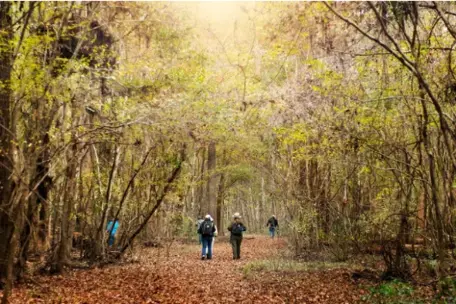
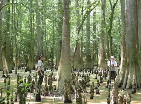
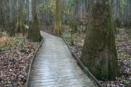
If you take a moment to examine Google Earth images of the southeastern US coastal plain, you will see "ribbons of green" trending NW-SE. These ribbons are in fact floodplain valleys, reaching 30 km in width. The Congaree National Park is in one of these ribbons, and it contains an expansive floodplain with the largest intact area of old-growth bottomland hardwood forest in the U.S. Commercial logging on the Congaree River floodplain ended in the early 1900s, and it was later held under conservation (e.g., hunt clubs). Intensive grassroots ecosystem preservation activities occurred in the 1970s and persisted until its designation as a national park in 2003. Hence, the park is a relatively pristine earth system and an ideal location to investigate how those "ribbon" floodplains form and operate. The purpose of this field trip is to visualize floodplain formation processes, review the low relief (typically <1m) topographic structures throughout, take in the expansive forest stands, canopy and undergrowth, and to conceptualize their interactions with inundation and drainage processes, at various scales.
Logistics
- Departure: Two 15-passenger vans from the School of the Earth, Ocean and Environment along with one from Enterprise will be used to drive participants, with the trip from campus taking roughly 45 minutes. Participants will leave from the University of South Carolina Law Lot adjacent to the Science & Technology Building (across the street from Jones) around on the morning of July 19. We will meet at about 7:30 a.m.
- Return: We will return to the departure location (Devine St. parking lot) around 4 p.m.
- Attire: Warm-weather clothes and sturdy tennis shoes. Open-toed shoes are discouraged. We will move between shaded and unshaded areas, so you may appreciate a hat.
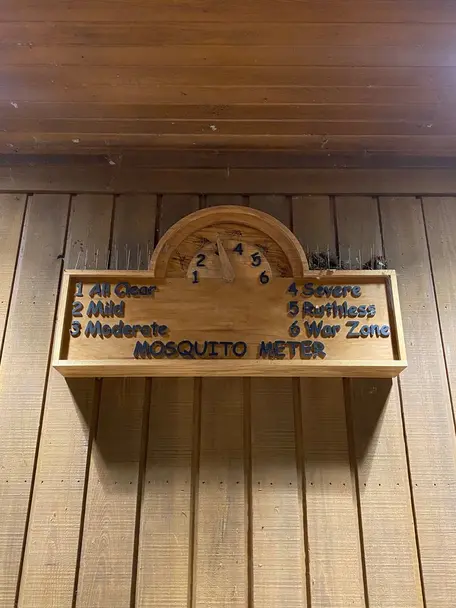
- To bring: Lots of water, snacks if desired, bug spray strongly recommended.
Location
Congaree National Park is located in central South Carolina and protects 27,000 acres of floodplain geology and hydrology, both of which influence this unique ecosystem. Prior to the late 1800s, the southeastern United States had more than 52 million acres of floodplain forest. Today the ecosystem within Congaree National Park preserves the largest intact area of old growth bottomland hardwood forest left in the United States, and contains many national and state champion trees. The purpose of Congaree National Park is "to preserve and protect for the education, inspiration, and enjoyment of present and future generations an outstanding example of a near-virgin, southern hardwood forest situated in the Congaree River floodplain in Richland County, South Carolina." The topography of the park has been shaped by many processes, including the migration of two rivers, changing sea level, faults, and the forest itself. Read more about the geology of Congaree National Park.
![[creative commons]](/images/creativecommons_16.png)
Strategy
The focus of this trip will be on geomorphology, floods and flooding. Discussions throughout will include the use of state and national parks for teaching purposes.
Itinerary
Note: Times are approximate.
7:30-7:45 Load up in vans in the parking lot at the corner of Greene and Main St, next to the Science & Technology Building and across from Jones Physical Science Center
Map link to vans: https://maps.app.goo.gl/kLKYGayhgNvSeBPT6
7:45-8:30 Drive to Congaree
8:30-11:30 Hike (~3.2 miles) - Introduction to Congaree River floodplain geomorphology with Drs. Ray Torres, John Cely and Haiqing Xu
11:30-12:30 Lunch on the sandbar by the Congaree River
12:30 Mini-hike to vans (~0.5 miles)
12:30-1:30 Load up vans, drive to Visitor Center. There will be time to explore the Visitor Center, visit the restrooms, and refill water bottles.
1:30-3 History of Congaree National Park with Ray Torres, floodplain channels with Haiqing Xu
3-3:15 Load up vans
3:15-4 Drive back to parking lot at the corner of Greene and Main St.
Cost and Registration
Pre-registration is required, and the fee is $75. Register for this (and/or the post-Rendezvous field trip) via the field trip registration form.