
For the Instructor
This material supports the Eyes on the Hydrosphere: Tracking Water Resources GETSI Module. If you would like your students to have access to this material, we suggest you either point them at the Student Version which omits the framing pages with information designed for faculty (and this box). Or you can download these pages in several formats that you can include in your course website or local Learning Managment System. Learn more about using, modifying, and sharing GETSI teaching materials.Welcome Students!
- Analyze the major reservoirs of the hydrosphere and the traditional and geodetic means of measuring their relative contributions to a water budget.
- Interpret real geodetic and traditional data sets from watersheds with different hydroclimatic regimes and assess short- and long-term trends in water availability for these watersheds.
- Use real data to evaluate the societal effects of changing water supply and demand related to both natural and anthropogenic forcings.
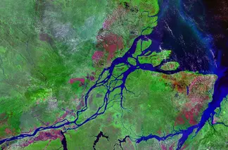
Unit 1: Exploring the Reservoirs and Pathways and Methods to Measure the Hydrologic Cycle
![[reuse info]](/images/information_16.png)
Unit 1.1 Introduction to the water cycle
Preparation prior to class
- Reading: As an introduction to the societal relevance of measuring water distribution and water's movement through the hydrosphere, your instructor may assign you to read one or more of the following articles related to the interaction between humans and water resources:
- Files:
- Unit 1.1 - Student Preparation Exercise (Acrobat (PDF) 298kB Jul15 20)
- Water cycle diagram color (Acrobat (PDF) 2.6MB Jul15 20)
Water cycle diagram black-white (Acrobat (PDF) 11.4MB Jul15 20)
Unit 1.2 Traditional and geodetic methods for measuring water resources
Preparation prior to class
Technique 1-pagers - you will be assigned to read one of these and watch the associated short video
- stream gaging: Unit 1.2 student preparation materials: stream gaging (Microsoft Word 2007 (.docx) 698kB Aug9 24)
- Short video: Streamflow Gaging Station and Measurement
- depth to groundwater: Unit 1.2 student preparation materials: depth-to-groundwater (Microsoft Word 2007 (.docx) 503kB Jun25 25)
- vertical GPS: Unit 1.2 student preparation materials: vertical GPS (Microsoft Word 2007 (.docx) 1.2MB Jun25 25)
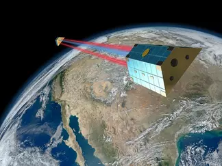
- GRACE: Unit 1.2 student preparation materials: GRACE (Microsoft Word 2007 (.docx) 2.1MB Jun25 25)
- Short video: GRACE: Tracking Water From Space or YouTube
- reflection GPS to measure snow depth: Unit 1.2 student preparation materials: reflection GPS and snow depth (Microsoft Word 2007 (.docx) 596kB Jun25 25)
- Short video: Measuring Snow and Soil with GPS
- SNOTEL: Unit 1.2 student preparation materials: SNOTEL (Microsoft Word 2007 (.docx) 1.8MB Jun25 25)
- Short video: Snow Science: Measuring Snowpack and SNOTEL
During the class meeting:
You will now be paired with classmates who researched different methods for measuring parts of the hydrologic cycle. Your group should have a representative for stream gaging, depth-to-groundwater, vertical GPS, GRACE, reflection GPS, and SNOTEL. First, each person should provide a ~5 minute summary of his/her/their method, including the items that you just discussed with your previous group. If you have any questions about a particular method, please ask during the presentation of that method. Once you have completed the presentations, please complete together as a group.
- Unit 1.2 Student expert group notes sheet (Microsoft Word 2007 (.docx) 206kB Mar4 23)
- Unit 1.2: How do we measure the hydrosphere? - student group exercise (Microsoft Word 2007 (.docx) 1.1MB Aug9 24)
Unit 2: Monitoring surface and groundwater supply in central and western US
In Unit 2, you will learn how the techniques for measuring the water system (covered in Unit 1) can be used to monitor both groundwater (High Plains Aquifer) and surface water (western mountain watershed) systems. You will investigate the impact of drought years and wet years on underground water storage in the High Plains Aquifer and on snowpack and surface runoff in Colorado. You will also consider the societal implications of droughts and how climate change may impact the water cycle.
Unit 2.1 High Plains Aquifer (central USA)
Preparation prior to class
Reading & homework
- Unit 2.1 Student Prep Homework (Microsoft Word 2007 (.docx) 1.2MB Aug22 24)
- Physical and Cultural setting of the High Plains Aquifer [USGS]
- The High Plains Aquifer - Can we make it last? [Stover & Buchanan 2017, GSA Today]
In class exercise
- Unit 2.1 Student Exercise (Microsoft Word 2007 (.docx) 3.1MB Mar5 23)
- Unit 2.1 Student Data Spreadsheet (Excel 2007 (.xlsx) 2.2MB Nov9 22) - the exercise is written assuming that the students will use Excel to view and interact with the water data. The graphs were not importing well into Google Sheets as the time of writing, so it would be best to steer away from that program.
Unit 2.2 Western Mountain Watershed (Colorado)
Preparation prior to class
Reading & homework
- Unit 2.2 Student Prep Homework (Microsoft Word 2007 (.docx) 207kB Aug23 24)
- Snowpack Levels Show Dramatic Declines Across Western U.S. [ScienceDaily 2018]
- Four Corners Drought Goes Beyond Extreme; No relief in sight [Cortez Journal 2018]
- Colorado's 2018 Fire Season Was One of the Worst Yet, and It's Not Over Yet [Denver Post 2018]
In class exercise
- Unit 2.2 Student Exercise (Microsoft Word 2007 (.docx) 7.2MB Jun25 25)
- Unit 2.2 Student Data Spreadsheet (Excel 2007 (.xlsx) 3.7MB Jun25 25) - the exercise is written assuming that the students will use Excel to view and interact with the water data. The graphs were not importing well into Google Sheets as the time of writing, so it would be best to steer away from that program.
Unit 3: What's in YOUR watershed?

![[creative commons]](/images/creativecommons_16.png)
Unit 3.1 Stakeholder analysis
Preparation prior to class
- Unit 3.1 Student preparation exercise for stakeholder analysis (Microsoft Word 2007 (.docx) 206kB Jul16 24)
Unit 3.2 Local watershed
- Unit 3.2 - student exercise questions (Microsoft Word 2007 (.docx) 204kB Jul17 24)
- Unit 3.2: Accessing hydrologic data for your region (PowerPoint 2007 (.pptx) 11.4MB Jul17 24)


