Initial Publication Date: January 29, 2010
Week 1: From the Outside Looking In —
Changing Our Perspective of Earth
top of page
Intro to Remote Sensing
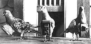
Remote sensing is the acquisition of information about an object by a recording device that is not in physical contact with it. Today, the term is commonly used to describe the process of collecting, viewing, interpreting, and analyzing aerial or satellite-based images.

Satellites of NASA's Earth Observing System. Click image to view larger in a new window. Image source: NASA.
Today, more than a dozen NASA satellites keep constant watch over Earth. These satellites provide an enormous amount of data and information that cover applications as diverse as forest fire monitoring and grassland inventory in Mongolia, early typhoon warning over the vast Pacific Ocean, flood assessment in coastal zones around the Bay of Bengal, and crop health and growth within the plains of the United States.
- To get a better understanding of the basics of remote sensing, check out the NASA feature article Remote Sensing . Read the following sections (or the entire article if you choose). Use the direct links below or navigate through the article using the section menu on the right hand side of the screen.
- Want to see some great examples of the wide variety of applications for remote sensing? Browse through the images in the article World of Change. Click on the individual images to access time series images and find out more about the changes shown.
- Here are some other sites full of fantastic information, images, and animations. Take some time to look at a few of them as you consider the question: How does remote sensing fit into your classroom teaching?
- Aquarius, set to launch in 2010, will provide the global view of sea surface salinity variability needed for climate studies. Be sure to check out the Animations Gallery.
- Landsat satellites have been photographing Earth for more than 30 years, giving people the opportunity to study our planet and evaluate dynamic changes caused by both natural processes and human practices. If you visit the Landsat site, don't miss the Images and Data pages, especially the EarthNow viewer, which lets you watch live as Landsat data are collected.
- Visit the MODIS Rapid Response System Image Gallery to browse recent and near real-time images taken from the Terra & Aqua satellites as the fly over the Earth's lands and coastal zones.
- NASA's Visible Earth Gallery is a catalog of images and animations from lots of different satellites and sensors. There's tons of great stuff here if you're up for the challenge of sorting through it.
Explore More If You Have Time
- NASA's Earth Observatory Image of the Day is a great place to find interesting (and current) images, stories, and discoveries about climate and the environment that emerge from NASA research, including its satellite missions, in-the-field research, and climate models. You can browse images by date or topic. Click on individual images for details and related stories.
- Need more ideas about how NASA data might fit into your classroom? Check out these NASA Featured Research Articles that describe, in story format, uses of Earth observing data.


