Declan De Paor, Akanksha Sharma, Nathan Williams, Arancha Pinan, Mladen Wild Dordevic, Melissa Beebe, Old Dominion University
This resource is no longer officially part of our collectionThis resource has been removed from our collection, likely because the original resource is no longer available.
If you have further information about the link (e.g. a new location where the information can be found) please let us know.
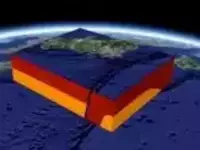
This selection of Google Earth and SketchUp files illustrate and model seismic zones using block models and cross-sections. Regions include Japan, Seattle, the Rockies, San Francisco, Iceland, the New Madrid fault, and I-64 (east coast of US), among others. Right-click each image to download a KMZ file for viewing with Google Earth. To examine KMZ contents, unzip and open the KML source doc with your text editor.
Subject: Environmental Science:Natural Hazards:Earthquakes, Geoscience:Geology:Geophysics, Structural Geology Resource Type: Audio/Visual:Images/Illustrations, Maps, Animations/Video, Collections Special Interest: Hazards Theme: Teach the Earth:Course Topics:Environmental Science, Teach the Earth:Incorporating Societal Issues:Hazards, Teach the Earth:Teaching Topics:Earthquakes, Teach the Earth:Course Topics:Geophysics, Structural Geology