Map of northern hemisphere permafrost extent


View Original Image at Full Size

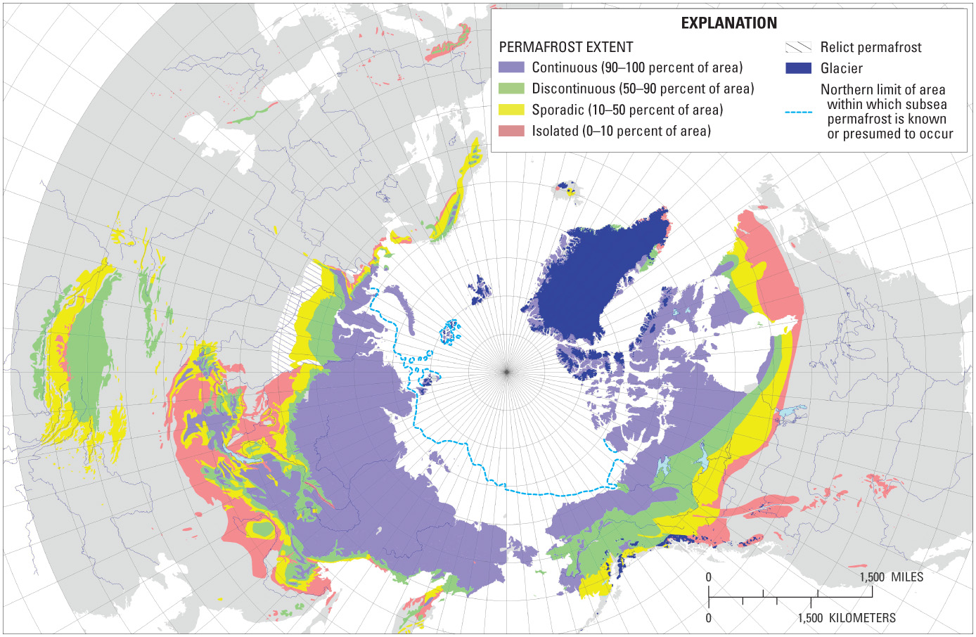
Permafrost is land in which the mean annual temperature has been below freezing for at least two years.
Originally uploaded in Integrate:Teaching for Sustainability:InTeGrate Modules:Modeling Earth Systems:Student Materials.

Image 51184 is a 906 by 1388 pixel WebP
Uploaded: Nov20 14


Last Modified: 2016-08-17 11:14:29
Permanent URL: https://serc.carleton.edu/download/images/51184/map_northern_hemisphere_permaf.webp

The file is referred to in 1 page
Provenance
This map comes from a USGS website: http://pubs.usgs.gov/pp/p1386a/images/gallery-5/full-res/pp1386a5-fig03.jpg linked to from the following page: http://www.usgs.gov/blogs/features/usgs_top_story/permafrost-its-chill/
Reuse
This item is in the public domain
and maybe reused freely without restriction.