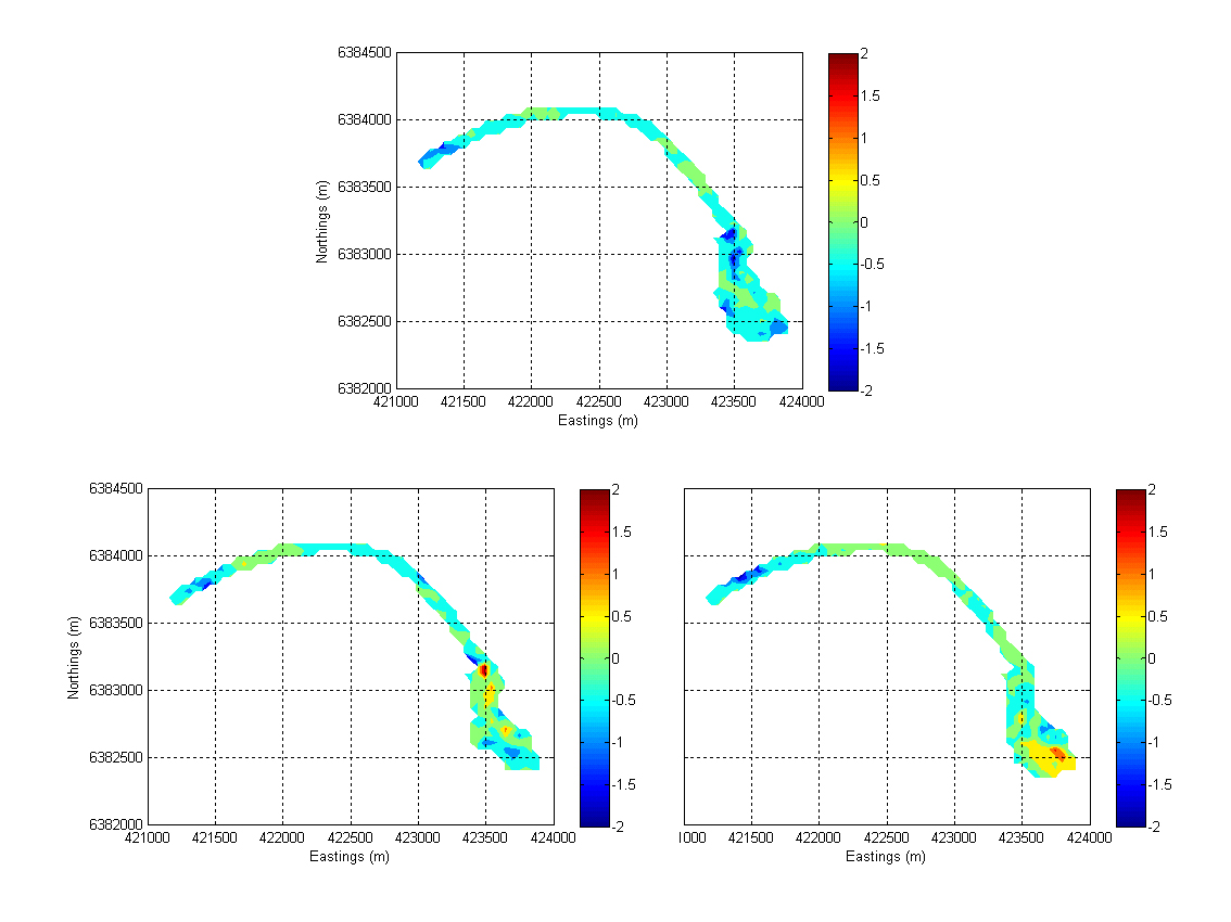
View Original Image at Full SizeFigure 4: Overall accretion/erosion occurring in the northern shoreline of Port Stephens estuary during low-energy high-frequency storms (upper panel, March to May 2007) and during high-energy low-frequency storms (lower panel, May to June 2007 and June to July 2007).
Image 16640 is a 850 by 1134 pixel WebP
Uploaded:
Aug17 09
Last Modified: 2009-08-17 01:30:50
Permanent URL: https://serc.carleton.edu/download/images/16640/figure_4_overall_accretioneros.webp
The file is referred to in 1 page
Provenance
Created by the author of the page containing
this file.
ReuseThis item is offered under a Creative Commons Attribution-NonCommercial-ShareAlike license
http://creativecommons.org/licenses/by-nc-sa/3.0/ You may reuse this item for non-commercial purposes as long as you provide attribution and offer any derivative works under a similar license.