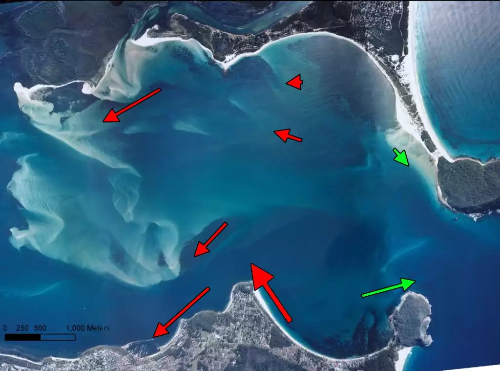
View Original Image at Full SizeAerial photograph showing the deployment locations and combined current velocity and duration index with dominant flow direction. Arrows are drawn to scale relative to index such that a longer arrow indicates a greater velocity or duration asymmetry.
Image 16617 is a 759 by 1024 pixel WebP
Uploaded:
Sep11 09
Last Modified: 2009-09-12 00:06:32
Permanent URL: https://serc.carleton.edu/download/images/16617/aerial_photograph_combined_cur.v2.webp
The file is referred to in 1 page
Provenance
Created by the author of the page containing
this file.
ReuseThis item is offered under a Creative Commons Attribution-NonCommercial-ShareAlike license
http://creativecommons.org/licenses/by-nc-sa/3.0/ You may reuse this item for non-commercial purposes as long as you provide attribution and offer any derivative works under a similar license.