photo_sediment_cores_showing.jpg


View Original Image at Full Size

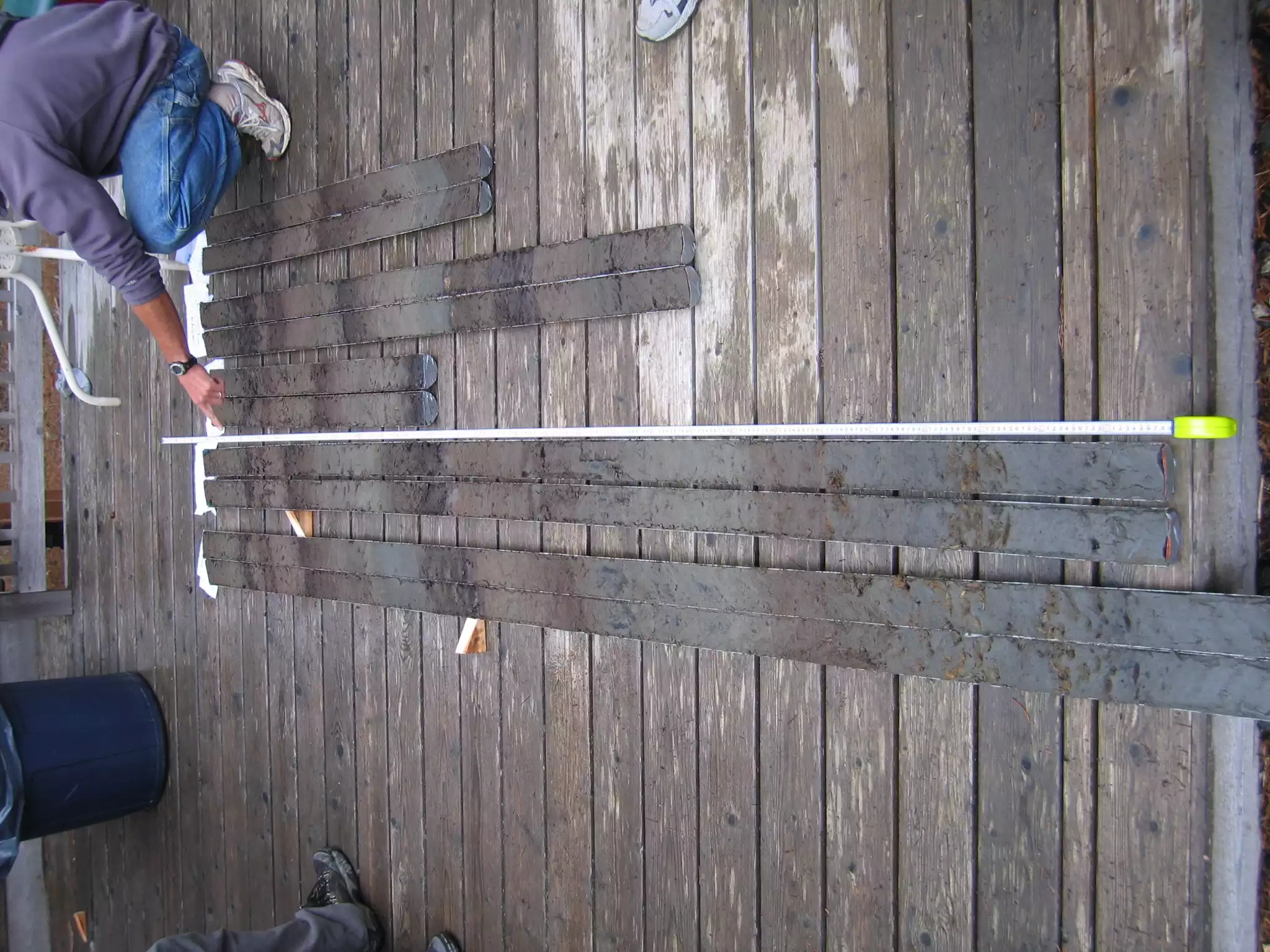
Figure 5. These cores, split open on a deck, were extracted from a coastal marsh in central coastal Oregon. The cores nicely show the alternation of buried soils (black and brown units) and tidal mud (gray to brownish gray units). The top of each buried soil represents a time of abrupt relative sea level rise (coseismic subsidence) during an earthquake on the Cascadia subduction zone. See text for further discussion.

Image 18543 is a 1536 by 2048 pixel WebP
Uploaded: Dec13 09


Last Modified: 2010-01-11 15:39:39
Permanent URL: https://serc.carleton.edu/download/images/18543/photo_sediment_cores_showing.webp

The file is referred to in 1 page
Provenance
Created by the author of the page containing
this file.
Reuse
This item is offered under a Creative Commons Attribution-NonCommercial-ShareAlike license http://creativecommons.org/licenses/by-nc-sa/3.0/ You may reuse this item for non-commercial purposes as long as you provide attribution and offer any derivative works under a similar license.