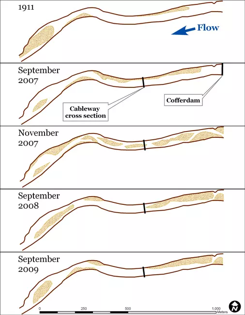
View Original Image at Full SizeFigure 4: Development of river bar planform [2-D viewed from above] over time. The dark brown lines were traced from the water's edge visible in September 2008 aerial photographs to serve as a common reference. The temporary transition to a multiple-channel planform is evident in the November 2007 survey. The cableway cross section is the location of the cross sections in Figure 5.
Image 18295 is a 3504 by 2730 pixel WebP
Uploaded:
Dec3 09
Last Modified: 2009-12-29 12:15:30
Permanent URL: https://serc.carleton.edu/download/images/18295/planform_development.webp
The file is referred to in 1 page
Provenance
Created by the author of the page containing
this file.
ReuseThis item is offered under a Creative Commons Attribution-NonCommercial-ShareAlike license
http://creativecommons.org/licenses/by-nc-sa/3.0/ You may reuse this item for non-commercial purposes as long as you provide attribution and offer any derivative works under a similar license.

