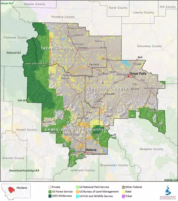
Rocky Mountain Front Land Ownership Map


View Original Image at Full Size

The Rocky Mountain Front region is defined in this report as the roughly 100-mile stretch of land on the east side of the Continental Divide that includes Cascade, Lewis and Clark, and Teton Counties where the plains meet the mountains just south of Glacier National Park. Created by Heaadwaters Economics https://headwaterseconomics.org/economic-development/trends-performance/monta... uploaded in Integrating Research and Education:Montana Geoheritage Project:Montana Geoheritage Sites:Augusta Choteau.

Image 182538 is a 841 by 745 pixel WebP
Uploaded: Apr13 18


Last Modified: 2018-04-13 09:28:05
Permanent URL: https://serc.carleton.edu/download/images/182538/rocky_mountain_front_land.webp

The file is referred to in 1 page
Provenance
Created by Heaadwaters Economics https://headwaterseconomics.org/economic-development/trends-performance/monta...
Reuse
This item is offered under a Creative Commons Attribution-NonCommercial-ShareAlike license http://creativecommons.org/licenses/by-nc-sa/3.0/ You may reuse this item for non-commercial purposes as long as you provide attribution and offer any derivative works under a similar license.