Changes in streambed elevation


View Original Image at Full Size

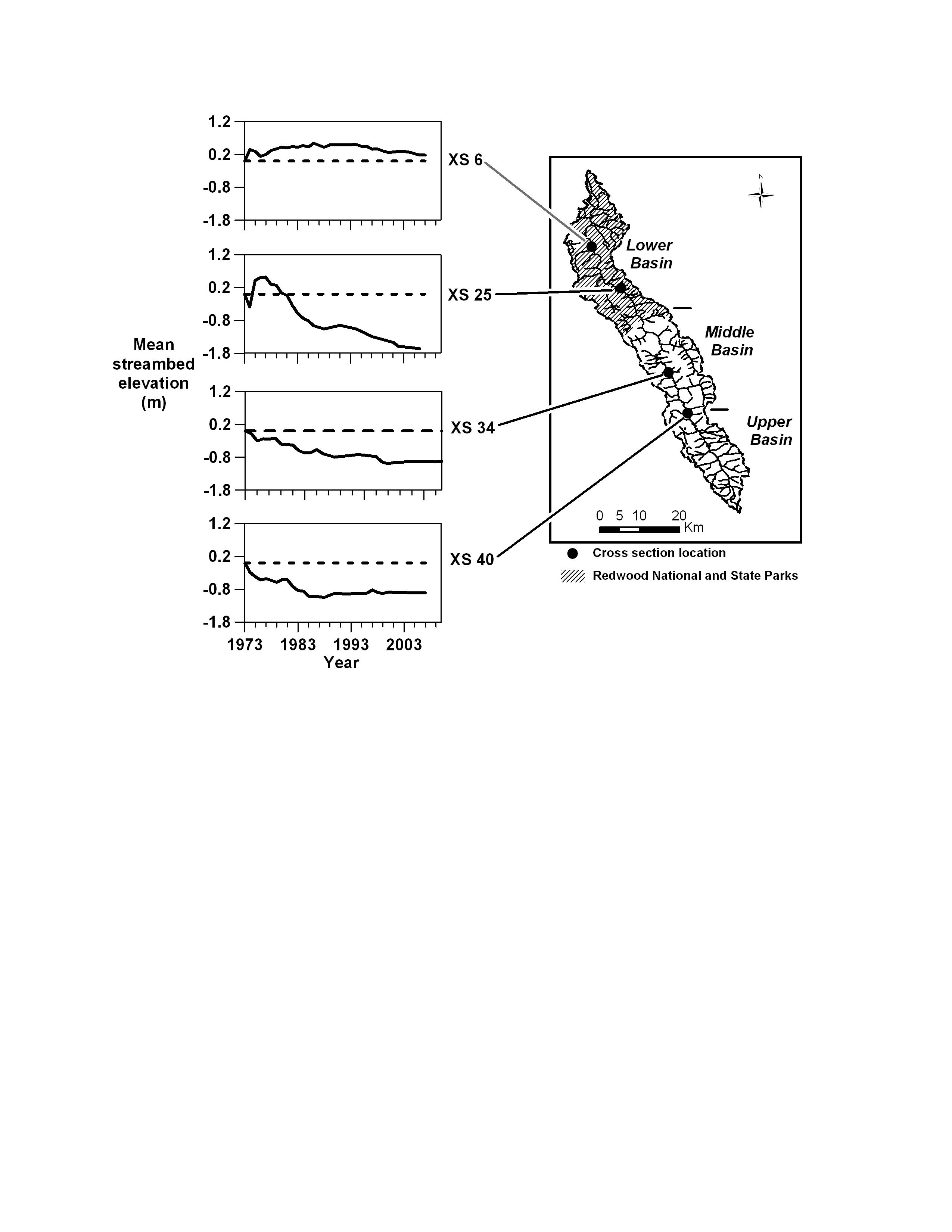
Figure 3. Change in mean streambed elevation at four representative channel survey sites (cross sections, XS) along Redwood Creek. Dashed line is zero; i.e., the bed elevation at the beginning of the surveys in 1973.

Image 17140 is a 3300 by 2550 pixel WebP
Uploaded: Oct8 09


Last Modified: 2009-11-05 12:36:04
Permanent URL: https://serc.carleton.edu/download/images/17140/changes_streambed_elevation.webp

The file is referred to in 1 page
Provenance
Created by the author of the page containing
this file.
Reuse
This item is offered under a Creative Commons Attribution-NonCommercial-ShareAlike license http://creativecommons.org/licenses/by-nc-sa/3.0/ You may reuse this item for non-commercial purposes as long as you provide attribution and offer any derivative works under a similar license.