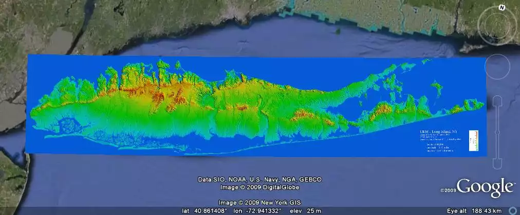
A Google Earth overlay of a Long Island digital elevation model developed by Gilbert Hanson at Stony Brook University
Image 17101 is a 419 by 1012 pixel WebP Uploaded:
Oct4 09
Last Modified: 2009-10-04 07:38:27 Permanent URL: https://serc.carleton.edu/download/images/17101/long_island_digital_elevation.webp
Provenance Glenn Richard, Stony Brook University
Reuse This item is offered under a Creative Commons Attribution-NonCommercial-ShareAlike license http://creativecommons.org/licenses/by-nc-sa/3.0/ You may reuse this item for non-commercial purposes as long as you provide attribution and offer any derivative works under a similar license.