
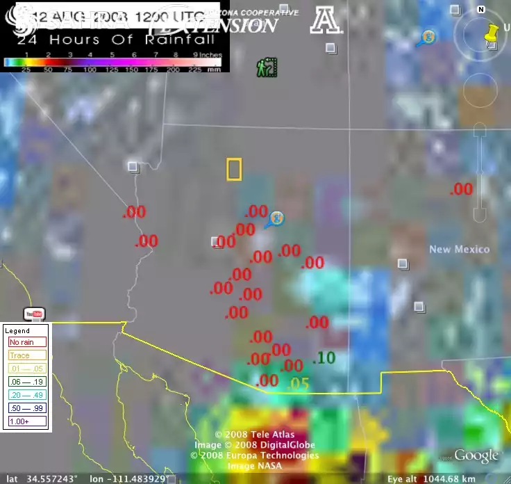
Precipitation gauge data from rainlog.org combined with GPCP 24-hour precipitation estimate showing concept of combined gauge/satellite browse tool. Ideally, the browser would afford access to data from all gauges within a single grid cell, and data over time.
Originally uploaded in Using Data in the Classroom:AccessData:Citizen Science Workshop.
Image 12759 is a 696 by 736 pixel WebP
Uploaded:
Aug12 08