Liang Bua Topography


View Original Image at Full Size

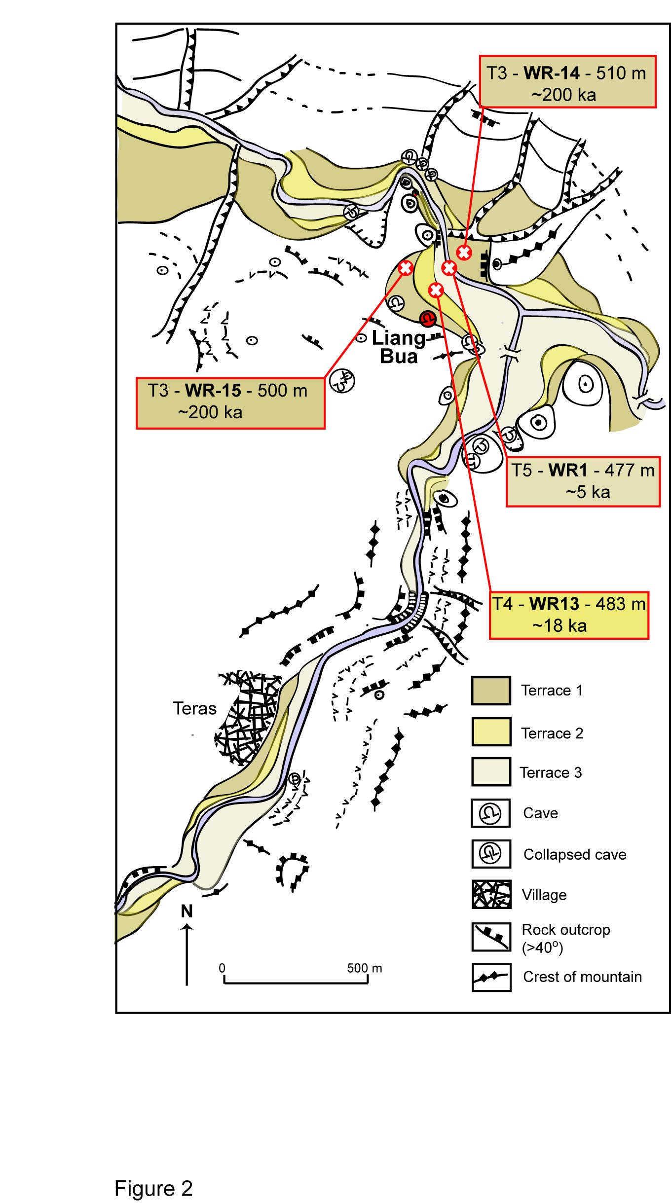
Figure 2: A geomorphological map of the topography close to Liang Bua.
The location of the sampling sites (red circle with a cross), terrace
number, age, sample code and height above sea level have been included
in boxes. Source: Westaway et al. (2009).

Image 16603 is a 2439 by 1360 pixel WebP
Uploaded: Aug16 09


Last Modified: 2009-11-17 08:48:24
Permanent URL: https://serc.carleton.edu/download/images/16603/fig2-vig1.webp

The file is referred to in 1 page
Provenance
Created by the author of the page containing
this file.
Reuse
This item is offered under a Creative Commons Attribution-NonCommercial-ShareAlike license http://creativecommons.org/licenses/by-nc-sa/3.0/ You may reuse this item for non-commercial purposes as long as you provide attribution and offer any derivative works under a similar license.