
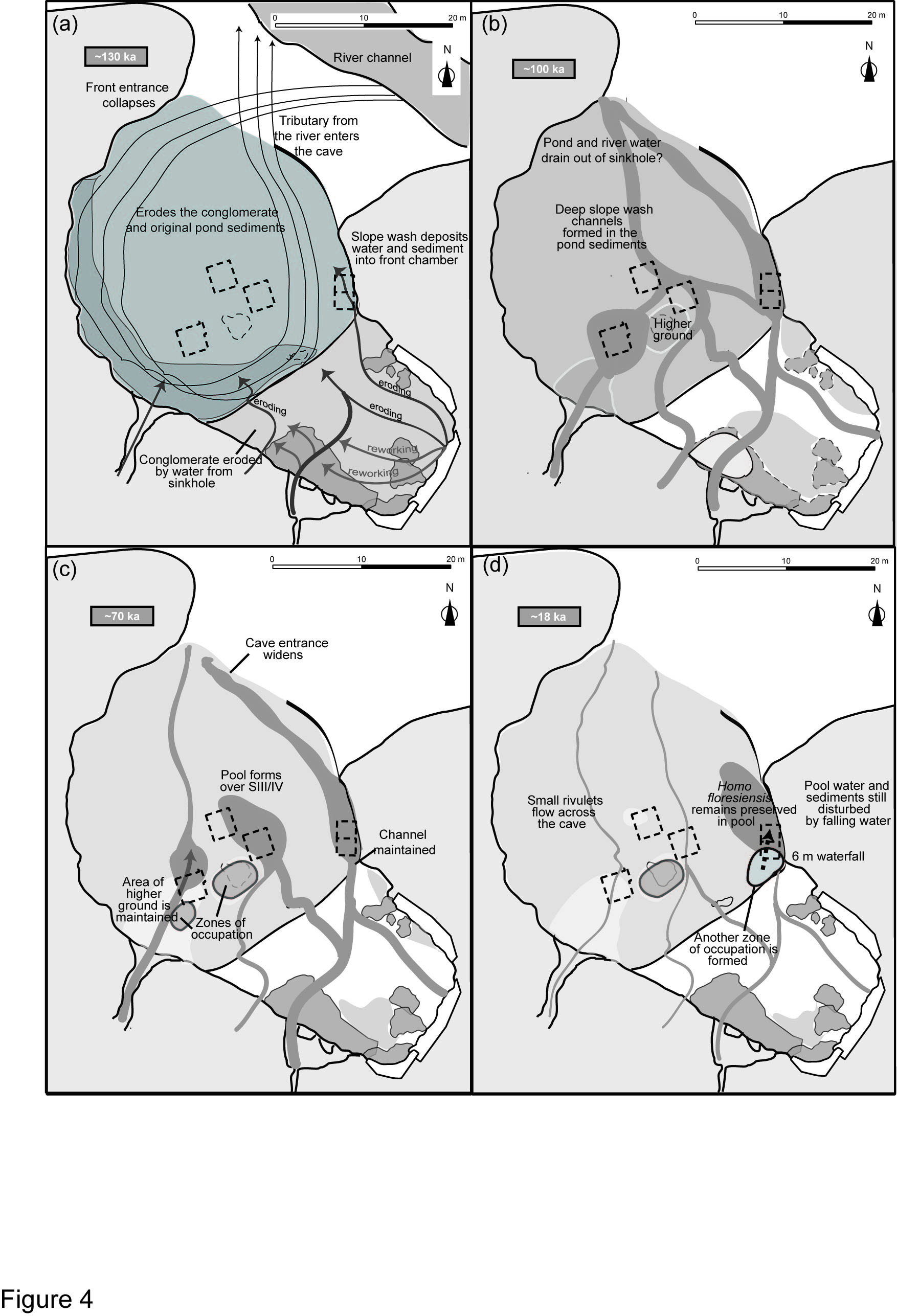
Figure 4: “Time slices” of the geomorphic evolution of Liang Bua
(a) 130 ka - the collapse of the front entrance and the erosion of the
deposits by a tributary (curved arrows) of the Wae Racang (solid unit)
combined with slope wash from the rear channels (thick arrows). (b) 100
ka - the removal of the pond water and the formation of channels created
areas of higher ground (light shading in front chamber) and an uneven
cave floor topography. (c) 70 ka - the formation of small, standing
bodies of water and the creation of small zones of occupation (dark
shading in the front chamber). (d) 18 ka - the creation of a new zone of
occupation in Sector XI. Westaway et al. (2009).
Image 16601 is a 2574 by 1754 pixel WebP
Uploaded:
Aug16 09