Impacts of El Nino and La Nina
Summary
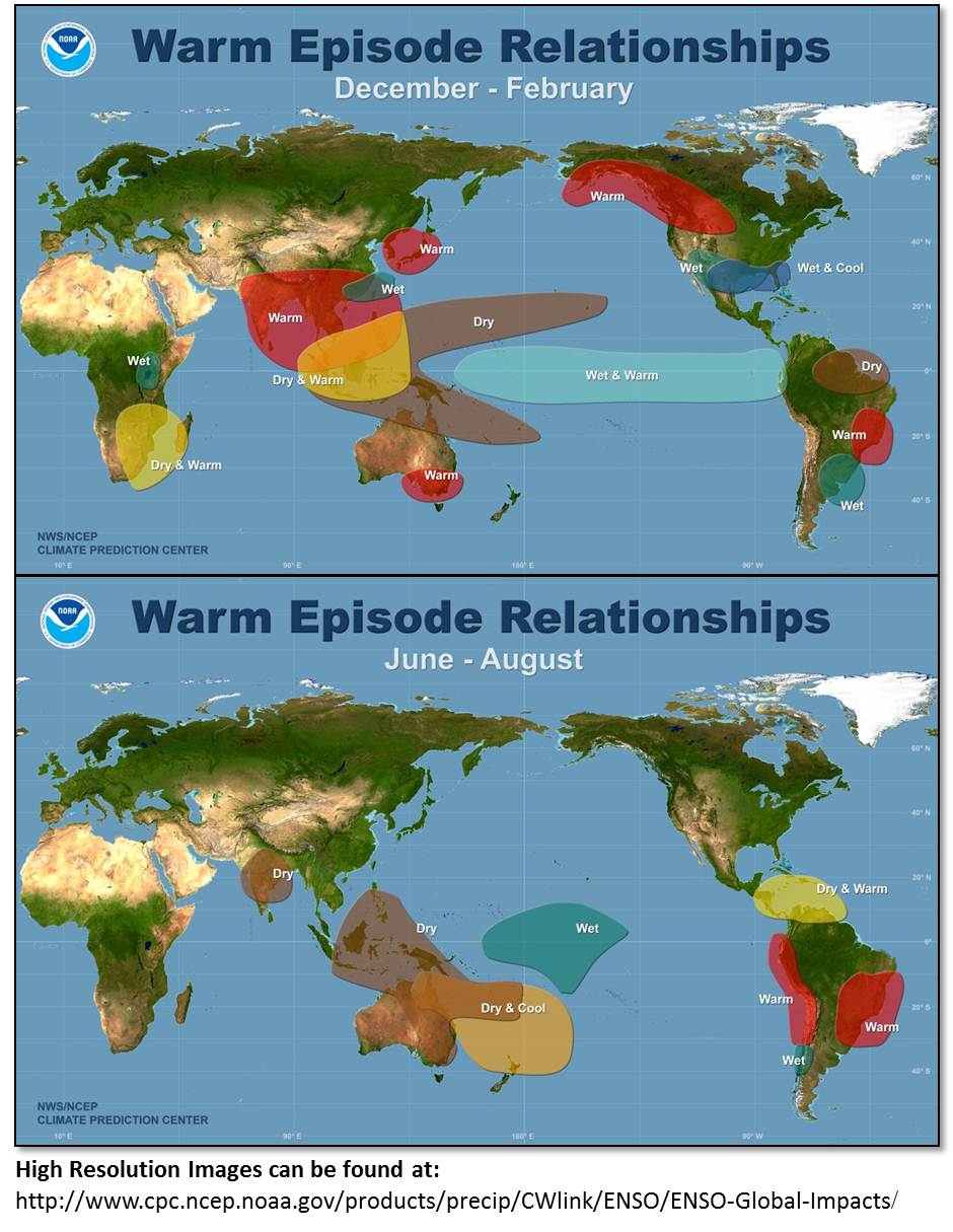
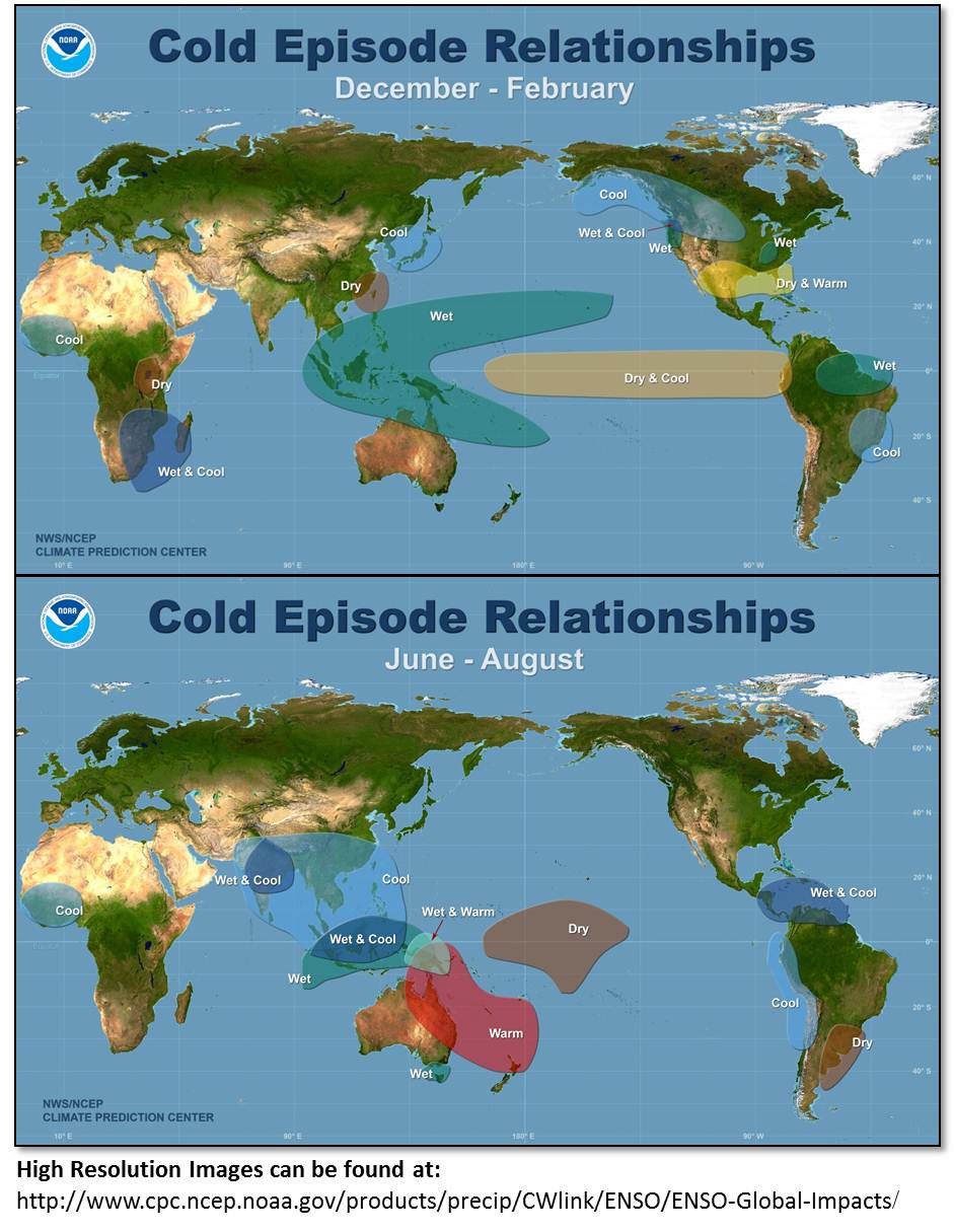
In this exercise, students explore NOAA and the Climate Data Center websites that provide information about El Niño. The students are then asked interpret a series of maps to describe the key changes in climate conditions during El Niño and La Niña. Two locations of emphasized: North America and Australia to illustrate the contrast in climatic changes and allow for determination of the impacts close to home.
Context
Audience
undergraduate course for non-science majors
Skills and concepts that students must have mastered
familiarity with web-browsing software
How the activity is situated in the course
This activity can be assigned as a stand alone homework or as an in-class activity if computers are available.
Goals
Content/concepts goals for this activity
- El Nino & La Nino
- Atmospheric Circulation sea surface temperature patterns in equatorial Pacific
- Climate Impact
Higher order thinking skills goals for this activity
- interpret graphical information
- synthesize data to draw conclusions
Other skills goals for this activity
Description and Teaching Materials
Teaching Notes and Tips
Assessment
Since the exercise is a series of questions based on reading and interpretation of maps, a simple rubric can be applied.